Above five thousand meters
India | Anno 1995
Tuesday, July 25 | Kaza – Jispa
Wednesday, July 26 | Jispa – Brandy Nallah
Thursday, Juli 27 | Brandy Nallah – Leh
Tuesday, July 25 | Kaza – Jispa
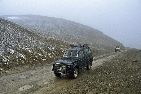
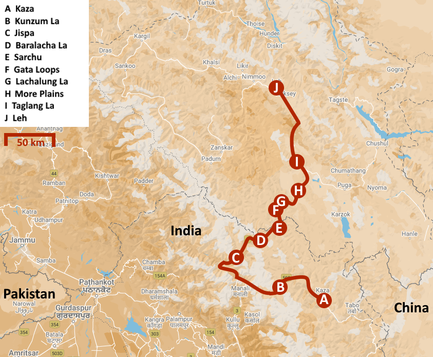
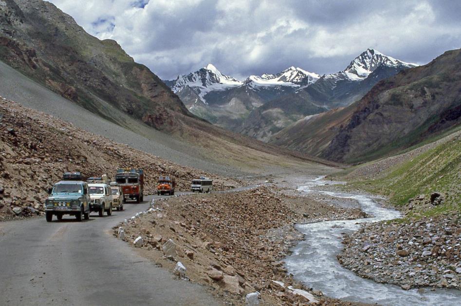
Midnight. Through the dusty streets of Kaza, Colonel Pardhan's truck disappears into the darkness, carrying our supplies and luggage, swaying into the night. We are allowed several more hours of sleep before we will follow in his trail. It will take three days before we reach our final destination, Leh in Ladakh, almost 550 km from here. First, we have to cross the Kunzum La again. Then, we head north on the Leh-Manali Highway, a route that will take us over four mountain passes at around five thousand meters each.
A route that will take us over four mountain passes at around five thousand meters each
Kaza
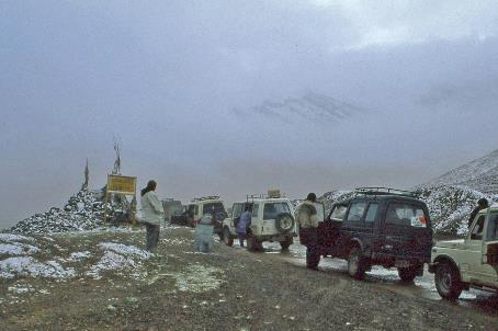
Not an everyday task, indeed. If we manage to cross the Kunzum La without too much difficulty, all problems will be behind us, predicts Anup. The radiant sun leaves no doubt – the weather will not hinder us in the slightest. We hope.
Spiti Valley |
|
|
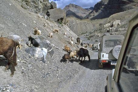
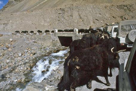
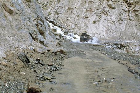
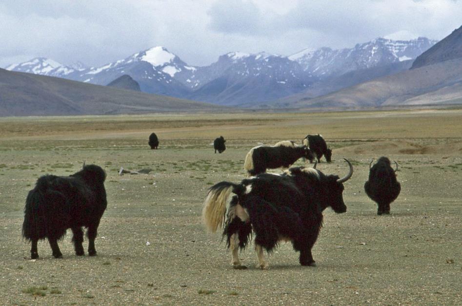
It must be said, the journey to Kunzum La goes smoothly. Less than three and a half hours after our departure, we stand at the top. Just as our jeeps struggled three days ago through mudflows in complete darkness, they now drive effortlessly uphill in broad daylight. There are no obstacles worthy of the name. A herd of goats, considering the road their undeniable territory, or a herd of yaks taking over a bridge can hardly be called obstacles.
Goats… |
|
…and yaks travelling with us |
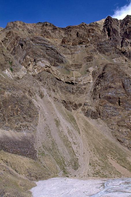
Enchanting erosion
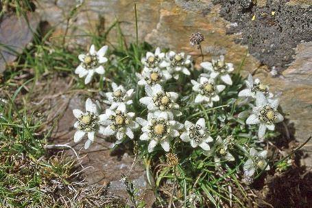
For a moment, we savour our time on this high mountain pass, carefully ensuring not to trample any edelweiss. In the distance, the CB12, CB13A, and CB16 glisten under a radiant morning sun. Each one rises above six thousand meters, these snow-covered peaks of the Chandra Bhaga Range. Together, there are so many – well into the thirties – that they have been given numbers rather than names.
Chandra Valley |
|
|
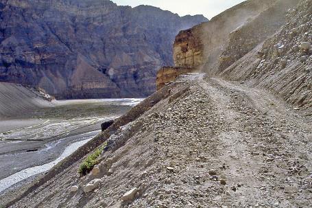
Even the slightest rainfall can cause mudflows and landslides
Chandra Valley |
|
|
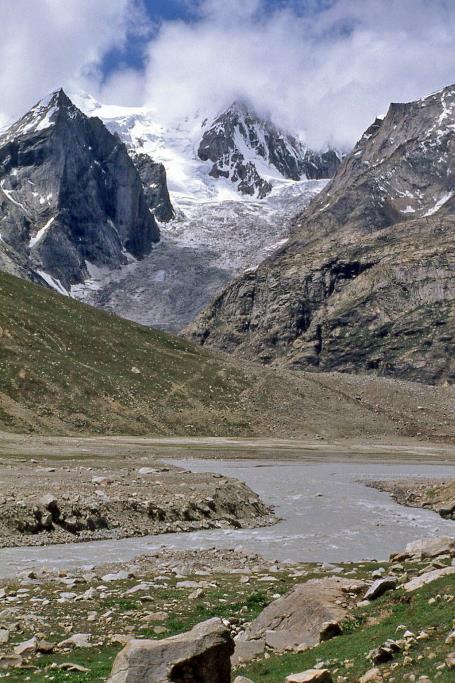
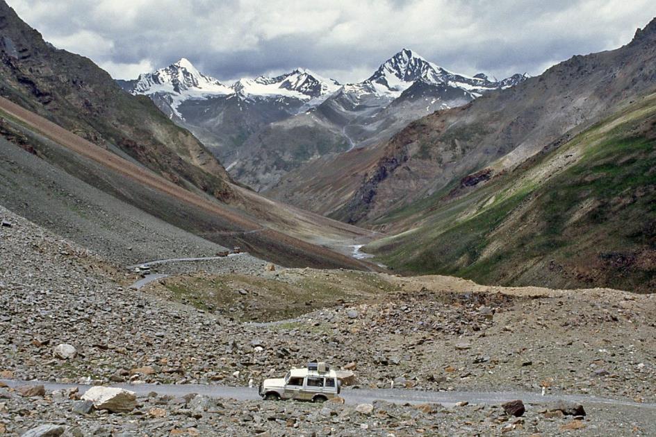
An hour later, the descent is also behind us, and we follow the Chandra downstream. The Bara Sighri Glacier reappears fairly quickly.
|
|
Bara Sighri Glacier |
Then, next to the road, the colonel's truck suddenly appears. His timing couldn't be better; we arrive exactly at twelve o'clock. Our cheerful jack-of-all-trades truly spoils us. In the midst of this rocky desert, he has discovered a comfortable strip of green along the riverbank. A delightful lunch, drinks chilled in the river's icy water, a tent in case it starts to rain, and as a finishing touch, a row of stepping stones through the river for those who need privacy when nature calls – that's all we need.
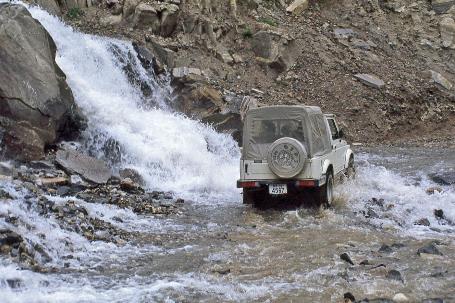
But the fun is short-lived. Shortly after, it starts to drizzle. The road is quite slippery now. Even the slightest rainfall can cause mudflows and landslides. Clear river water frequently cascades over the road.
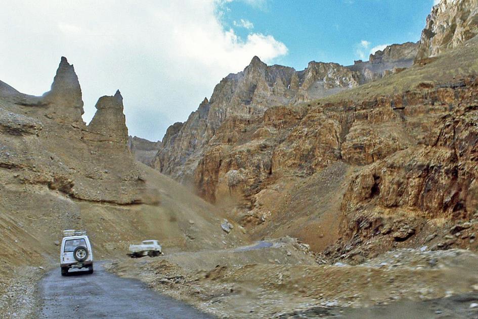
Just before three, we reach the Leh-Manali Highway in Gramphu, and a bit later, we stop at the Koksar checkpoint. A lot of people, loud music, noisy trucks, and buses – we're not used to that anymore. We preer yaks and goats. There's nothing wrong with our passports and visas, and half an hour later, we're allowed to continue our journey.
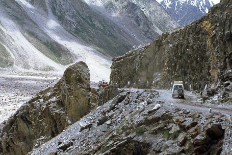
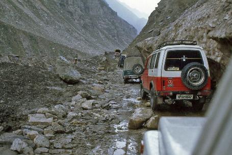
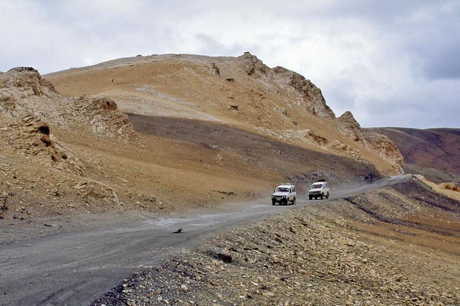
That turns out to be easier said than done. Yesterday, the road was completely closed at Rumpan Nallah. Only this morning, a bulldozer cleared the path, but the damage is still visible here and there. It's not just stones scattered over the road; these are actual boulders that the jeeps have to manoeuvre through.
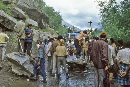
A man climbs onto the boulder, swings the hammer widely, and inch by inch drives the chisel deeper into the rock
Rumpan Nallah |
|
|
Soon, a boulder appears that turns out to be a bit too heavy to simply move aside. The giant, estimated to weigh at least half a ton, has positioned itself right in the middle of the road. There's no way to pass. From the chatter among the drivers, Anup gathers that this is the result of the Indian army's attempts to alter the course of the river using dynamite.
About ten drivers enthusiastically tackle the obstacle with minimal tools – a mere three crowbars. Despite much shouting, pushing, and pulling, the boulder remains unmoved. Then a hammer and a chisel come into play. A man takes the lead, climbs onto the boulder, inserts the chisel into a crack, swings the hammer broadly, and drives the chisel deeper into the rock, millimetre by millimetre. Dozens of spectators watch closely without any form of protection. Amid loud cheers, the boulder eventually splits in two. With much effort, both fragments are finally pushed aside. The entire delay lasted barely an hour. This is India.
Further down the road, in the middle of the way, lies the decaying carcass of a hit donkey, its legs stretched out in front of it. You can easily drive around it. Cleaning up is unnecessary; let nature do its work.
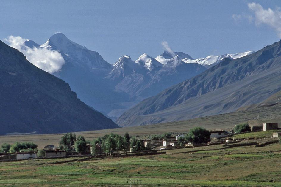
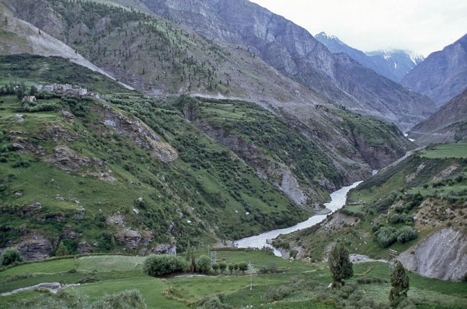
Tandi is the place where the Chandra merges with the Bhaga, giving rise to the Chenab, one of the five mighty rivers of Punjab, almost a thousand kilometres long. It's sometimes referred to as the artery of Punjab.
Bhaga Valley
The jeeps now turn the steering wheel northeast. The next twenty-four hours, the Bhaga Valley will be our habitat. Upstream, we will follow the river all the way to its source. It starts right away with a steep climb to Keylong, as we have seven hundred meters of altitude to conquer.
Where on earth can you find a spare part for a truck at this hour?
Then, in the half-light, a new obstacle suddenly appears. This time, it's a truck blocking the road. Broken steering, says the driver's diagnosis. Our spirits sink. It's already past seven o'clock. Where on earth can you find a spare part for a truck at this hour?
Premature concern, as it turns out. Barely ten minutes later, the steering is repaired. We don't even dare to ask for the technical details of that feat. With a mix of relief and astonishment, we continue our journey – relief because the delay was quickly resolved, astonishment because we've seen up close the condition these trucks are in.
Little do we know that this place will be wiped off the map by a landslide next year
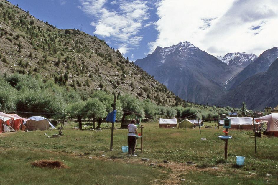
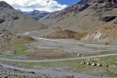
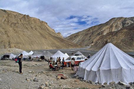
Jispa tent camp
It's half past seven when we arrive at the tent camp of Jispa, our first stop along the Leh-Manali Highway, 3,142 meters above sea level. It's almost dark as we walk through the marshy grass to our tents. Little do we know that this place will be wiped off the map by a landslide next year.
Bhaga River
Wednesday, July 26 | Jispa – Brandy Nallah
Despite heavy rains and bitter cold, we sleep excellently in our tents. In the warm morning sun, breakfast is delightful. Today will be a leisurely day, with only one mountain pass ahead. Because we can no longer ignore it, our road book is too ambitious.
We can no longer ignore it, our road book is too ambitious
So adjustment is necessary. Hence, instead of staying overnight in Pang as planned, we'll stay in the nearby Brandy Nallah. This reduces the daily distance from 160 km to 110 km. What's more, it shifts two challenging mountain passes to tomorrow's stage. Plenty of time to leisurely enjoy the landscape. The fact that the police checkpoint in Darcha takes twenty-five minutes to check our visas doesn't bother us at all.
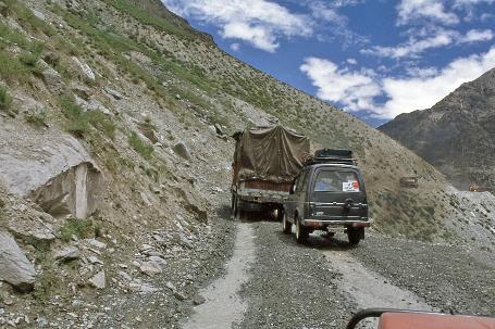
Whenever lorry trucks or tanker trucks cross each other, it's a risky endeavour
|
|
|
The weather is promising, but the condition of the highway is not. Mudflows and mountain streams cross our path abundantly. Often, it's nothing more than an unpaved trail we drive on, just one lane wide. Vehicles other than lorry trucks and tanker trucks are scarcely seen. Each time they cross paths, it's a risky endeavour.
Yet, it's crucial for Ladakh, this supply route from the south. Overland, only the route from Kashmir offers an alternative – from Srinagar via Kargil to Leh, a distance of 434 km. Not an easy choice, given the ongoing tensions between Hindus and Muslims in turbulent Kashmir. What we don't know, however, is that just now in Kargil, three bridges have been washed away. If you want to go to Leh, there is currently no alternative for our route.
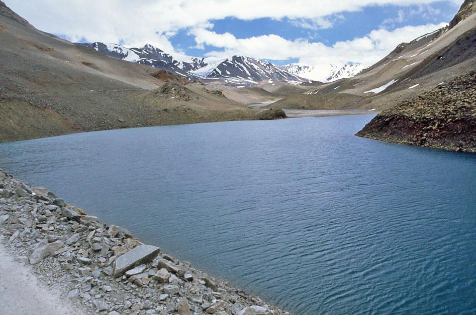
Just before twelve, we reach Deepak Tal, at an elevation of 3,750 m. In the sun-drenched landscape, the crystal-clear glacier lake looks fabulous but rather wrinkled today. The gusty wind has put a stop to the photogenic reflections this lake is known for.
What we don't know, however, is that just now in Kargil, three bridges have been washed away
Towards Baralacha La
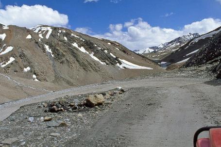
Through the imposing landscape, we continue our journey. The summit of Baralacha La is approaching, the first of the four high mountain passes. We still have to overcome a little over eleven hundred meters in altitude. The approach to the pass already promises to be magnificent.
It's a strange sight when we suddenly spot the colonel among the remnants of a stone enclosure. An empty stomach is of no use when standing up there in the cold, he must have thought. So, he has utilized this spot – probably the only form of shelter for miles around – to set up his lunch quarter. The chilly wind howls around us, the Bhaga crashes down behind us with a wild roar, but the lunch is excellent, and the scenery is unparalleled.
Suraj Tal
Steadily, we climb further up through the Bhaga valley. Hairpin turns follow one after another. Once again, a glacier lake appears. It is Suraj Tal, the Sun Lake, 4,750 meters above sea level. Due to its unique location, this water mass of almost a kilometre long is considered sacred. Many call it the source of the Bhaga. That's not entirely accurate; the stream must originate somewhere higher up. But it is suspected that there is an underground connection.
The last stretch turns out not to be the most challenging
The last stretch turns out not to be the most challenging. It's half-past two when we stand on top of Baralacha La, a broad saddle ridge with its 4,890 meters just slightly higher than Mont Blanc. It's windy and cold up there, raining a bit, but the edelweiss is in full bloom.
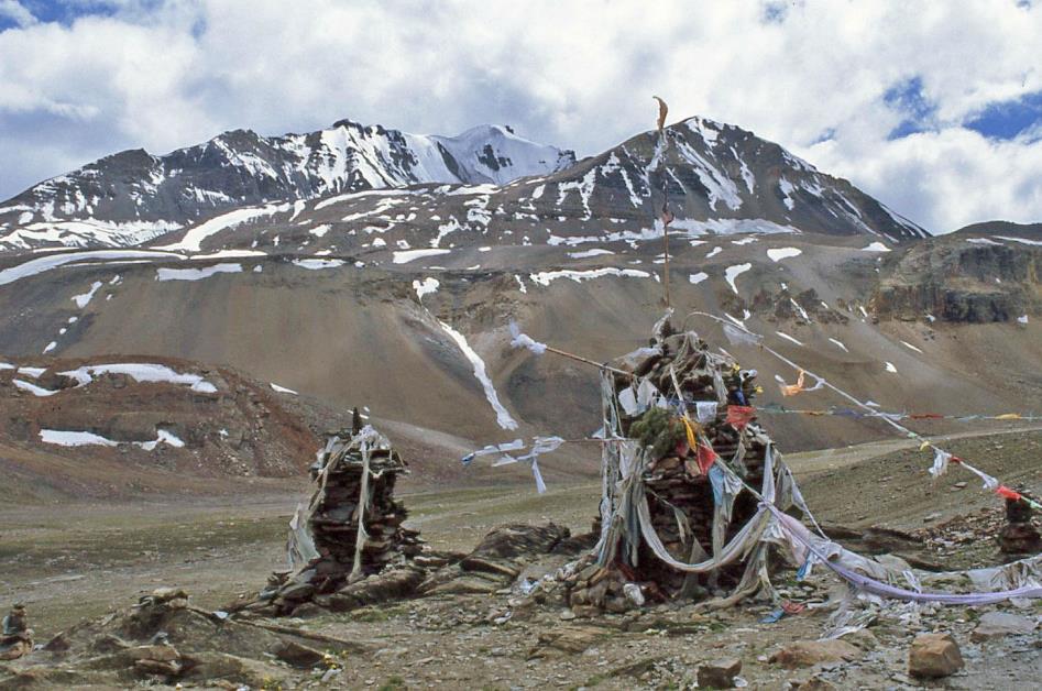
Baralacha La (4,890 m) with cairns
Two carefully stacked piles of stones or cairns mark the summit. Prayer flags full of mantras flutter vigorously in the wind. With each movement one of those flags makes – and there are quite a few – those mantras rise to the sky as if uttered by people. This way, travellers have known themselves protected by the gods for centuries when undertaking this perilous journey. Originally, it must have been a colourful spectacle of the five Buddhist colours – blue, white, red, green, and yellow. But by now, they have become frayed, colourless rags. At this altitude, UV rays, winds, and temperature differences show no mercy.
Edelweiss |
|
|
A rough descent follows now; the unpaved road doesn't improve, but at this altitude, we don't have to fear river crossings. On the right, the early course of the Yunam keeps us company. On the horizon, deep blue, sharp rock masses dominate, their slopes and tops covered with patches of eternal snow.
In a curve, a camp with about seven tents emerges. Bharatpur City, that's what the driver calls the place, with a mix of respect and mild mockery.
Tent camp of Bharatpur City |
|
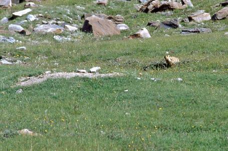
Himalayan marmot |
Then, the valley fans out into a broad plain flanked by bare mountains that have shed winter snow for some time. At the base of their slopes, where the debris from the hills gathers, the stone desert surprisingly turns green. There, amidst the luxurious grass, Himalayan marmots feel at home. Whistling, they signal the arrival of our windy jeeps to anyone willing to listen, before excitedly disappearing into their burrows.
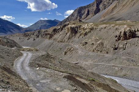
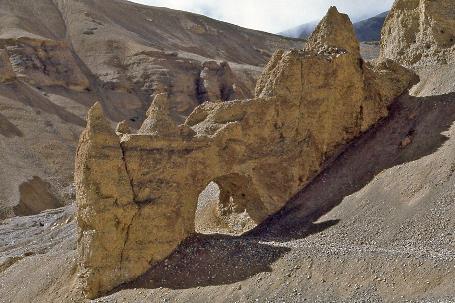
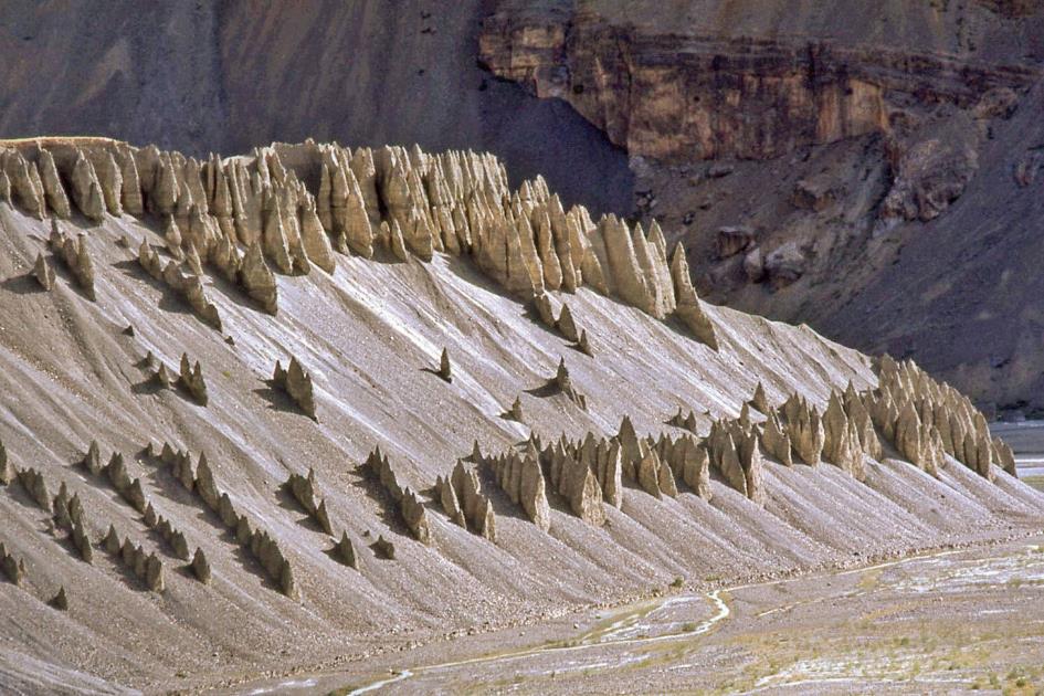
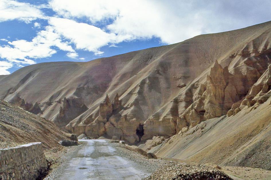
For many thousands of years, the Yunam has been carving its way through this soft sediment. It encounters little resistance, resulting in a watercourse almost as straight as a canal. In a network of narrow streams, the grey meltwater flows through the excessively wide riverbed northward. On either side, the riverbanks rise meters high above the water.
As if immune to erosion, they adorn the riverbanks like pinnacles on the roof of a Gothic cathedral
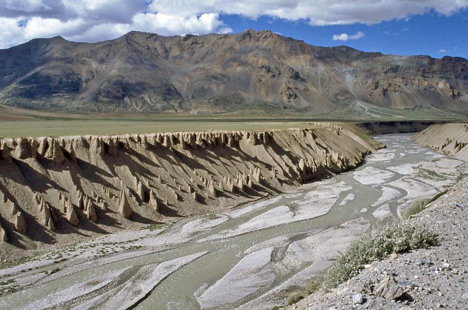
Year after year, the river widens a bit more because each spring, the deluge rushing down from the mountains takes a substantial bite out of those soft walls. Nevertheless, hundreds of small, pointed peaks manage to withstand the annual onslaught. As if immune to erosion, they adorn the riverbanks like pinnacles on the roof of a Gothic cathedral.
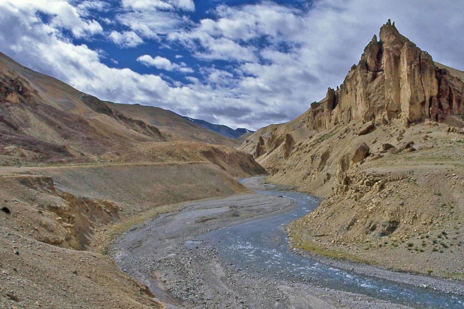
Just after four, we reach Sarchu, where the Yunam merges into the Tsarap. It's not much more than a dozen dhabas and a few tent camps where you can eat and sleep. The settlement owes its significance mainly to its location – roughly halfway between Leh and Manali. If you want to cover this gruelling journey in two days, you settle down here for the night.
For us, this is primarily the place where we fulfil our border formalities. Because about ten kilometres ahead, we leave the state of Himachal Pradesh behind and enter the state of Jammu and Kashmir. An internal border crossing, but in this country, it is taken seriously. So seriously that it can sometimes be tumultuous. Despite Sarchu's seemingly inconspicuous appearance, both states claim jurisdiction.
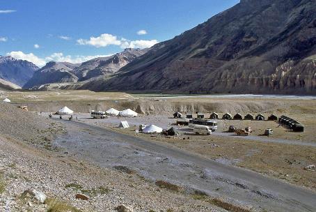
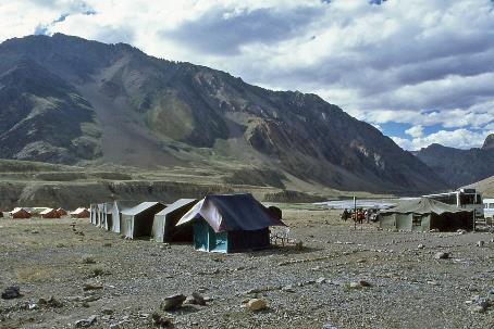
A bit surprisingly, a tent camp called Brandy Nallah awaits us
Soon, we continue our journey, this time along the broad Tsarap. The valley is possibly even more impressive than that of the Yunam earlier. Just before five, we reach the Brandy Nallah tent camp, the endpoint of our second stage. This is marked as our highest overnight stay ever, at 4,170 meters above sea level.
Brandy Nallah tent camp |
|
|
A bit surprising, a tent camp named Brandy Nallah. But Anup knows why. A bit further, Whisky Nallah flows into the Tsarap. For the thirsty traveller, the water of that stream tastes like whisky – hence the name. Naming the tent camp after that stream was an obvious choice. However, it couldn't be done because on the other side of the mountain pass, there was already a tent camp with that name. So, they opted for Brandy Nallah. Logical, right?
Thursday, Juli 27 | Brandy Nallah – Leh
Five in the morning. The mountains are shrouded in mist, and here and there, we can see layers of fresh snow. Sticking our nose outside the tent teaches us that it's bitterly cold out there. Inside too, for that matter. Yet, there's no escaping it. With a stage of over 220 km ahead, an early start is imperative. Shivering, we reduce the morning ritual to the strictly necessary. There's no more than a quick wash.
Two incense sticks burn on the dashboard; the driver has recited a prayer
Cold rain splashes on the windshields as our convoy sets in motion. Two incense sticks burn on the dashboard; the driver has recited a prayer. Not surprising, as we have the two highest mountain passes ahead. A bit of heavenly assistance is welcome.
We follow the Tsarap for only a few kilometres until we stand at the foot of the famous Gata Loops. This is the most spectacular part of the route. Twenty-one hairpin bends spread over seven kilometres take us almost five hundred meters higher, from 4,170 m to 4,650 m. It is said that this barren slope is haunted. Not so long ago, a driver was reportedly stranded here and perished from hunger, thirst, and cold. You can still sometimes see his spirit begging for water.
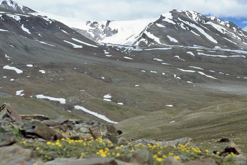
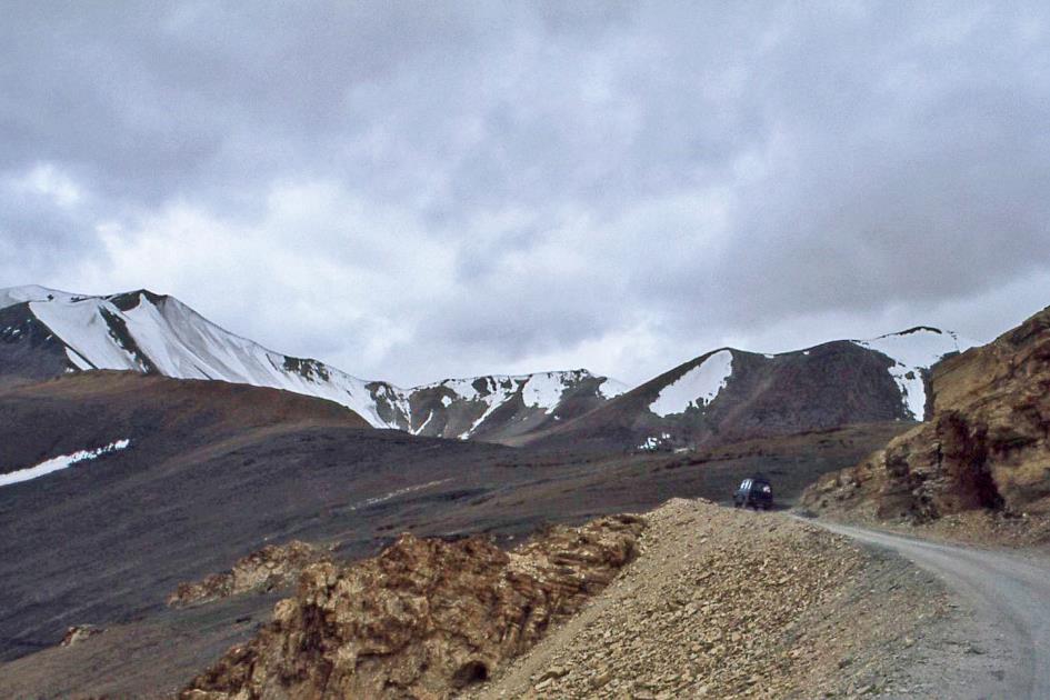
But we don't notice any of that. Nor do we pay much attention to the breathtaking landscape. As we climb higher, the rain turns into snow. We don't even realize that we are crossing the Nakee La, a mountain pass at 4,739 m. In this gigantic landscape, it's no more than a small wrinkle in the relief.
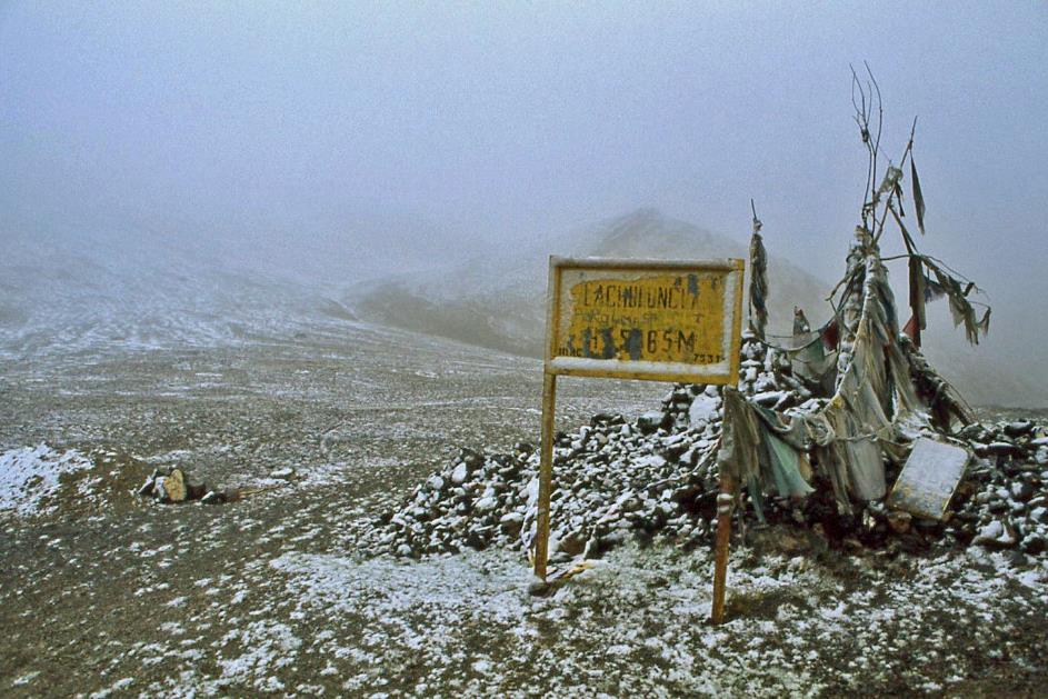
Then, on the banks of the Whisky Nallah, the tent camp of the same name emerges. The better part is now coming – the ascent to our first mountain pass above five thousand. As impressive as this high mountain range is, the approach to the Lachalung La cannot be called truly spectacular after everything we've seen before. The significant altitude differences are already behind us.
However impressive this high mountain range may be, you can't truly call the approach to the Lachalung La spectacular
|
|
Lachalung La (5,065 m) |
It's not even eight in the morning when we reach the top, 5,065 meters above sea level. Mists have the mountain pass in their grip, and we can only see a few hundred meters ahead. Pale prayer flags, laden with a layer of snow, hang motionless above a messy cairn. Today, no mantras will ascend to the heavens here. But you can't keep us quiet; snowballs fly around.
Pale prayer flags, laden with a layer of snow, hang motionless above a messy cairn
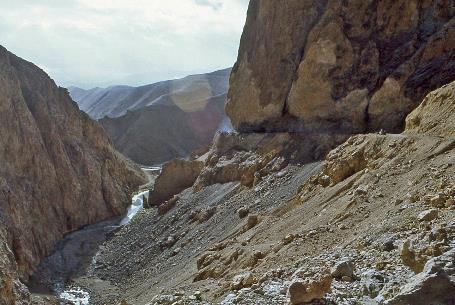
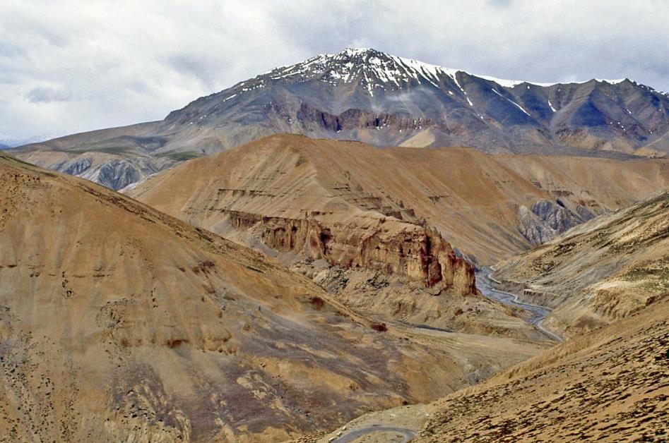
A seemingly ordinary stream guides us downhill. However, by now, we should know better. In this monumental environment, nothing is ordinary, not even a stream. The gorge that the Kangaljal Nallah has carved into the soft rock is truly overwhelming.
Kangaljal Nallah
|
|
|
Kangaljal Nallah
It's like a catalogue of erosion forms as we descend. We better retract our not-so-wise remarks about the landscape not being particularly spectacular.
Pang tent camp |
|
|
On a small bridge over the Kanglajal Nallah, we stand under the blue sky, enjoying the radiant sun for a moment, less than three-quarters of an hour after we tried to dispel the mists with snowballs. Just before nine, Pang emerges – a collection of dhabas and a tent camp, the place where we originally planned to stay overnight. Truckers brush their teeth and wash their hair with the icy river water. Like us, two young Dutch travellers are on their way from Manali to Leh. However, not in jeeps, but on bicycles, as if it were a ride through the flatlands. That seems like a hallucinatory endeavour to us. Yet, their morale shows no signs of wavering.
We better retract our not-so-wise remarks about the landscape not being particularly spectacular
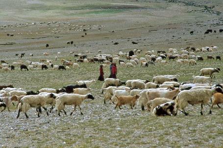
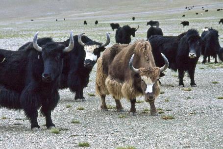
More Plains with yaks
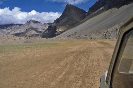
The surprises are not over yet. A few hairpin bends later, the high mountain range opens up to the vast More Plains, forty kilometres long, three to seven kilometres wide. Elsewhere, this might not be surprising, but at an altitude of 4,750 meters, it's quite uncommon. It feels like driving over a billiard table here, zooming along forty kilometres on the asphalt, always straight ahead. No river crossing, no mudflow, no hairpin bend, no debris cone, no boulder – nothing, not even a dead donkey obstructs the way.
Every summer, they come to this plain because it's excellent grazing land. Although sometimes you have to search for the blades of grass with a magnifying glass
Pashmina goats |
|
Yaks |
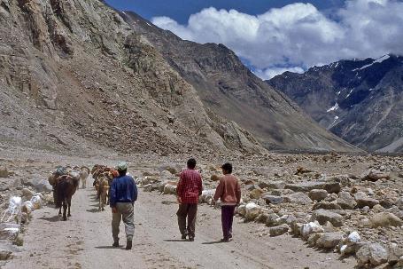
The plain seems as lifeless as the barren mountains we've been traversing for days. But the drivers know better. We leave the comfortable asphalt road behind and continue to bounce through the steppe. It doesn't take long before we come face to face with dozens of grazing yaks. These colossal cattle with their menacing horns, upright shoulders, and long, silky fur almost reaching the ground can be intimidating. But they are not dangerous, just like the hundreds of pashmina goats grazing a bit further.
Changpa
|
|
|
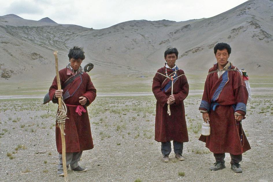
Three men and three women watch over the herds. They belong to the Changpa, a nomadic people found only at high altitudes in Western Tibet and Jammu and Kashmir, in areas where nobody else wants to live. Breeding yaks and goats is their only source of income. They make a living by selling milk, wool, hides, and meat. Every summer, they come to this plain because it's excellent grazing land. Although it's hard to imagine, sometimes you have to search for the blades of grass here with a magnifying glass.
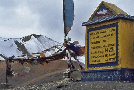
Towards the Taglang La
One more mountain pass to go, but what a pass it is. With its 5,309 meters, the Taglang La would be the second-highest motorable mountain pass in the world. Only the Khardung La north of Leh, at 5,500 meters, would surpass it slightly. As is often the case, these claims should be taken with a grain of salt. Worldwide, there are at least a dozen motorable passes that are higher than the Taglang La. But for us, that doesn't dampen the excitement. We'll never get closer to the gods.
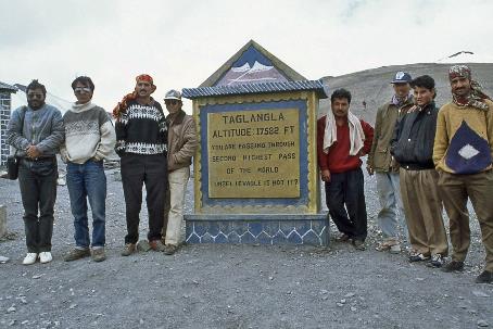
Just before twelve, we reach the summit. Luck is on our side; the sun is shining, and the sky is clear. A fierce wind howls over the ridge, prayer flags tug vigorously at their ropes, and mantras ascend continuously to the sky. A stone monument reminds us of the unique character of this place. Proudly, our team poses around the structure.
A fierce wind howls over the ridge, prayer flags tug vigorously at their ropes, mantras ascend continuously to the sky
Taglang La (5,309 m) |
|
Our team with guide and drivers |
You are passing through the second-highest pass in the world. Unbelievable, is it not?, it says. What is truly unbelievable is not the fact that we are standing here. It's that we stand here at ease, as if we are overlooking the Flemish Ardennes. But appearances can be deceiving. These altitudes show no mercy. The air pressure here is only half that at sea level. Consequently, the amount of oxygen is also halved. Our nine-day stay above two thousand meters, including six days above three thousand meters, is now paying off. Our bodies have had some time to adapt. Heart rate and breathing have increased, there is improved blood flow to muscles and brains, and our blood now carries a horde of new red blood cells, thanks to the EPO enzyme that cyclists are familiar with by now.
However, all of this consumes a lot of energy. Vital bodily processes, such as building muscle mass, remain neglected. Along with adaptation, inevitable decay sets in. Adaptation is at its best after three weeks, and from then on, decay takes over. For ordinary mortals like us, a prolonged stay above five thousand meters is therefore ruled out. Even experienced climbers are advised not to stay at this altitude for more than six weeks. However, some population groups in the Andes and the Himalayas seem to have no difficulty with a permanent residence above five thousand meters. Genetic adaptations are the only explanation for that.
In our blood, hordes of new red blood cells have appeared, rushing to distribute the scarce oxygen
Not staying at this altitude for too long is our takeaway. This is convenient since the only thing left for us is a two-thousand-meter descent to the Indus Valley. The landscape is no longer as spectacular, and there isn't even a river to accompany us. Only in Rumtse, the very first settlement worthy of the name, does the Gya River make its appearance. But the colonel is there with his final lunch for us. As a dessert, he has a cake with a wink – See you again.
Then we continue downhill along the Gya. Like the Kangaljal, it has carved a deep gorge through the mountains. Turn after turn reveals impressive erosion forms. Reportedly, the unusual, ever-changing colours of the rock walls are also striking. However, we don't see much of that because it has started raining. Gradually, trees reappear in the scenery.
Just before four, at Upshi, we enter the Indus Valley. We were waiting for this, yet it still surprises us a bit how the steep mountain walls suddenly give way to the broad valley. In essence, our expedition through the Himalayas ends here. We have only fifty kilometres to go to Leh, the capital of Ladakh. But that's peanuts. The adventure seems to be over.
Ladakh remains mostly a mountain desert. Not even the Indus can change that much
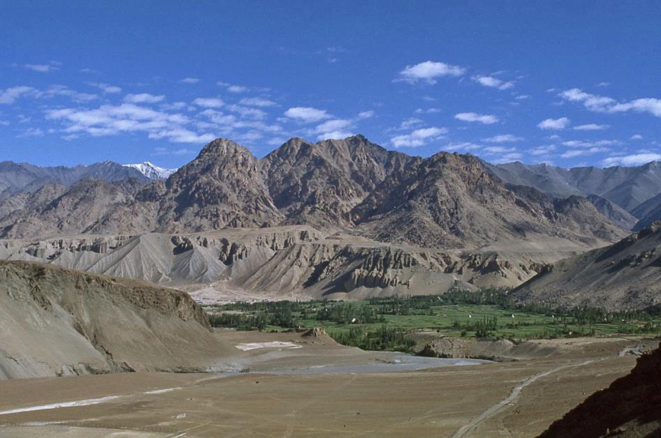
Indus Valley
Compared to the other major rivers draining the Tibetan Plateau – Yellow River, Yangtze, Mekong, Salween, Brahmaputra – the Indus may seem like a minor player. However, two thousand kilometres downstream, it will grow into the lifeline of its basin. What the Nile is to Egypt, the Indus is to Pakistan.
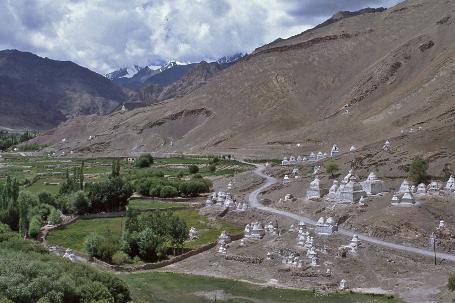
Chortens or stupas |
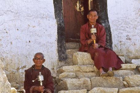
|
Monks with prayer wheels |
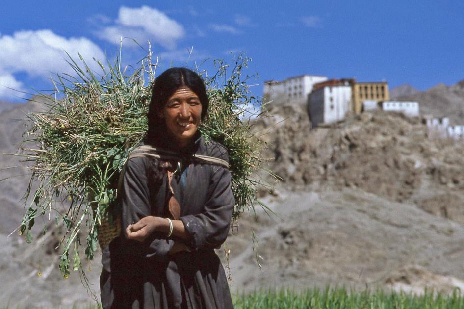
But Ladakh remains mostly a mountain desert. Not even the Indus can change that much. Over the centuries, settlements have emerged around green oases on the riverbank. If you scan the barren mountain slopes, you often discover the white buildings of a gompa overlooking such a village. Memories of the Spiti Valley come to mind once again. Numerous small, white chortens, the Tibetan version of a stupa, appear in unexpected places.
Gods who feel at home in the Spiti Valley will certainly not complain about a stay in Ladakh
You can't escape it; this valley breathes Buddhism from every pore. Gods who feel at home in the Spiti Valley will certainly not complain about a stay in Ladakh.
Jaak Palmans
© 2024 | Version 2024-01-15 17:00
Continue reading in (5/5)