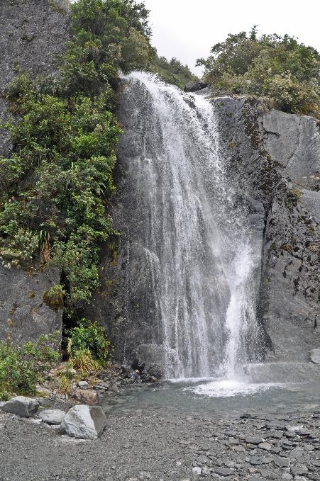
Glaciers in the rainforest
New Zealand | Anno 2019
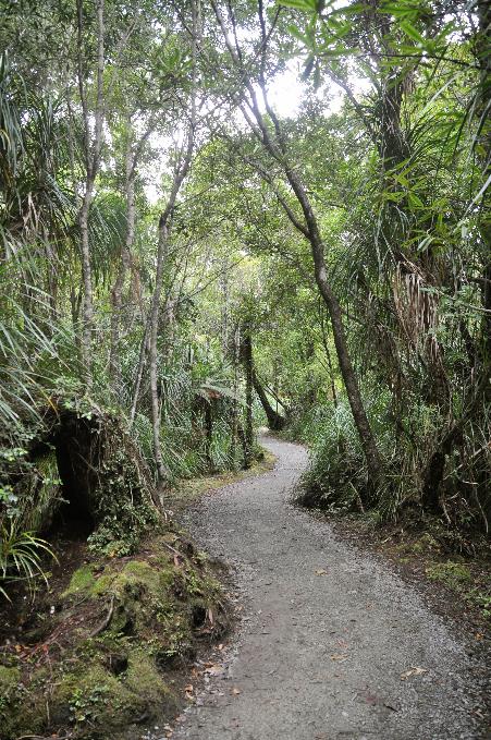
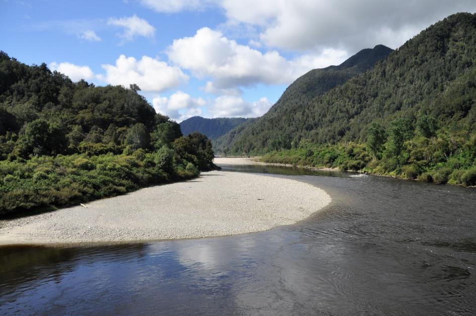
Sunday, March 17 | Nelson – Punakaiki
Monday, March 18 | Punakaiki – Franz Josef Village
Tuesday, March 19 | Franz Josef Village – Fox Village
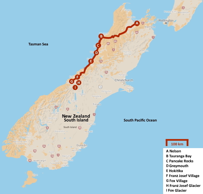
Sunday, March 17 | Nelson – Punakaiki
Wet Coast, they sometimes call the West Coast. You can expect rain every other day. On an annual basis, this results in a water column of about 2,850 mm. However, for now, it doesn't seem like we have to fear precipitation. The sun shines in the blue sky, and the weather forecasts suggest that there won't be any changes in the near future.
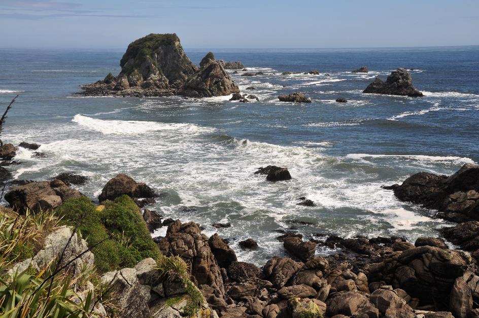
Why do we venture into these wet areas in the first place? It's all about the unique nature that awaits us. We have rugged coasts and impressive glaciers on the horizon, but also peculiar pancake rocks and playful fur seals.
Wet Coast, they sometimes call the West Coast
And we are not the only ones who think this way. No tourist will overlook these gems. This is abundantly clear from... the road surface. White arrows are regularly painted on it, indicating the correct direction for each lane. Just to keep foreign drivers on the right track – which is the left lane.
For nine hundred kilometres, until next Friday, SH6 will be our constant companion. Every now and then we’ll meet a settlement, such as the small Wakefield. The village has three thousand inhabitants. That's not a lot, unless they all have to be evacuated suddenly. That happened last month when wildfires approached dangerously close. Fortunately, they ultimately escaped unharmed.
One-lane bridges are more of a rule than an exception on the West Coast. They are often bailey bridges that barely rise above the riverbank. Vehicles cannot pass each other on these bridges. If there's already a vehicle on the bridge, you'll have to wait, following the principle of first come, first served. Although that's usually not a big issue since there isn't much traffic.
In case of severe weather causing a bridge to wash away – which is not uncommon – these one-lane bridges can be relatively quickly repaired
There are quite a few rivers that flow down from the mountains and intersect our path. Hence, the government opts for this modest bridge type. Moreover, in case of severe weather causing a bridge to wash away – which is not uncommon – these one-lane bridges can be relatively quickly repaired. This is not a luxury, considering that SH6 on the West Coast is the only north-south connection.
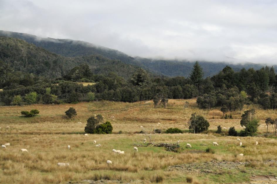
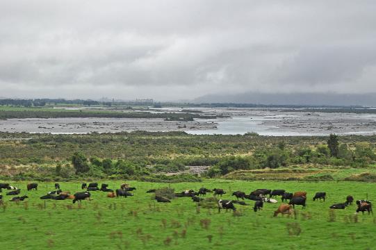
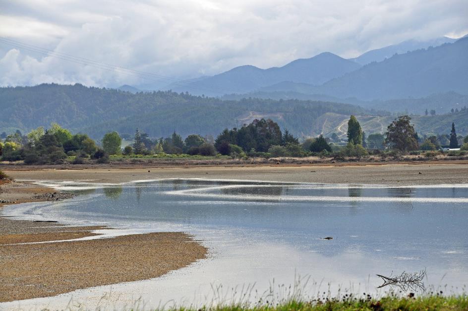
With the sun at our back, we drive towards the ink-black clouds on the horizon. There is not much habitation in the wide, green glacial valley. We have left the vineyards behind us. Sheep graze in the meadows, occasionally accompanied by cows. In the distance, the mountain slopes are covered with pale grass.
Then the valley narrows. Dense forests cover the steep slopes. Gradually, we climb into the clouds ourselves. Just after half-past nine, we reach Hope Saddle, at 634 meters, our highest point for today.
Suddenly, on the other side of the pass, we tumble into the mist. Only briefly, as these clouds have come drifting in from the west and their passage is blocked by the mountain peaks. Soon, we find ourselves back in the sunshine.
To our right now stretches Kahurangi. In Māori, it means precious possession – a fitting description for this green jewel. It is the second-largest national park in New Zealand.
Now, it's the mighty Buller River's turn to guide us to the sea. It's sometimes called the Black River because it turns black when rains wash tannin from the forests.
Murchison was once the scene of the world's first non-military suicide bombing
You wouldn't think it of Murchison, but this modest village of barely 500 inhabitants was once the scene of the world's first non-military suicide bombing. If we are to believe the local Lions Club, that is, as they have dedicated a plaque to commemorate it. A man called Joseph Sewell wasn't pleased to be accused of cattle theft. With sticks of gelignite tied around his body, the angry farmer appeared before his judge on July 14, 1905. In the end, he was the only one to be torn to pieces. Literally.
As sleepy as the tiny Murchison is today, it was bustling in the months after November 14, 2016. A severe earthquake had shaken the Kaikoura region on the east coast. SH1 – the only north-south route along the east coast – was closed for months. For traffic from Picton to Christchurch, SH6 in the west was the only solution. Trucks, buses, cars... it all rolled through the village incessantly.
The valley now narrows to a narrow gorge. Buller Gorge it is, the canyon that the mighty river has carved out over time. The river meanders more than 70 kilometres between the mountains, without even considering if there is still enough room for the precarious asphalt ribbon. In the meantime, the sun is putting its best foot forward.
The valley briefly unfolds at Inangahua Junction. It's not more than a crossroads with a handful of houses and a small station. Cows graze on the lush green meadows.
Kilkenny Lookout
Before long, the densely wooded slopes close in again like a theatre curtain that only leaves a slit open. With winding twists, the Buller continues to find its way to the sea. Wherever you look, on the slopes or on the banks, an abundant green nature unfolds that seems to know no bounds – podocarps, ferns, shrubs. From Kilkenny Lookout, we gaze out over all that beauty.
A sign by the road imparts a life lesson: “You are a long time dead. So what’s the hurry?”
Speed demons are not welcome on this winding stretch. A sign by the road imparts a life lesson: You are a long time dead. So what’s the hurry?. It's a quarter past twelve when the gorge definitively unfolds to the wide coastal plain. The sun generously casts its rays over the land. There are hardly any clouds in the sky. Our enthusiasm is rapidly growing.
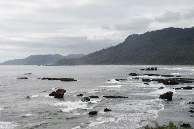
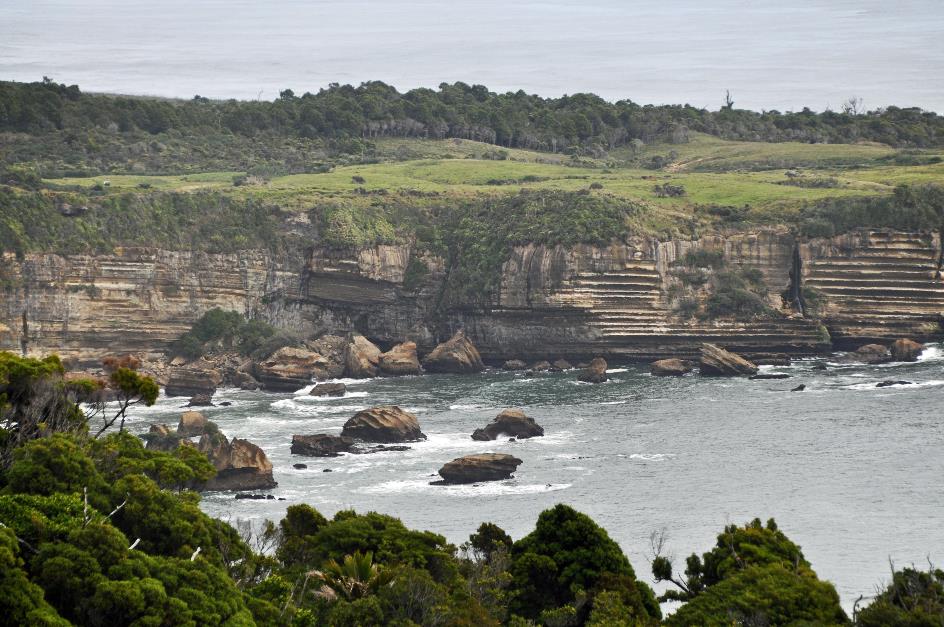
Thus, we reach Westport at the mouth of the Buller, a port town that relies mainly on fishing, coal mining, and dairy farms. Tourism is becoming increasingly important as well. Hardly have we turned our backs on Westport than we look out over the Tasman Sea. Four hundred kilometres long, it will be our companion for the next few days. And we appreciate that prospect. Because what we see at the window promises a lot – the glints of the sun on the undulating seawater, the wild foaming surf, the robust but lush vegetation, the ever-changing view of bizarre rock formations, green islets, and grey cliffs along the coast. The fact that a few clouds have appeared in the meantime doesn't bother us much.
You can indeed call this area desolate. Less than one percent of the New Zealand population has settled here. In the early 20th century, there was a brief change when acute gold fever flooded the West Coast. Gold prospectors tried their luck in rivers and valleys. But that resurgence was short-lived.
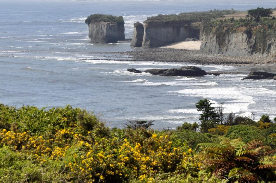
Cape Foulwind
On foot, we climb to the windy Cape Foulwind. When Abel Tasman approached these regions back in the day, this must have been one of the first coasts that caught his eye. Erroneously, he thought he was dealing with the South American Staten Island, as we now know.
A quote from his ship's journal reminds us of this in Old Dutch: Staete Landt dit is Beseijlt ende Ondeckt met de Scheepen Heemskerck ende Zeehaen onder het Commandt vanden E Abel Tasman Inden Jaere 1642 Den 13 Dexember, which means This is Staten Island, sailed around and discovered by the ships Heemskerck and Zeehaen under the command of E Abel Tasman in the year 1642 on December 13th.
Cape Foulwind
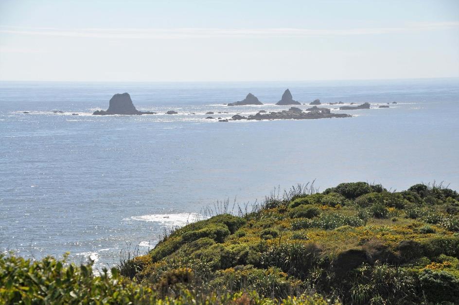
Close to the coast, some rocky islets rise ominously from the water, resembling dangerous cliffs. Sufficient reason for Tasman to name this cape Clyppygen Hoeck in Old Dutch, which can be translated as Rocky Point. However, Captain Cook had a different opinion. In 1770, he gave the cape its current name, Cape Foulwind, because he got fed up with the stormy weather and treacherous winds.
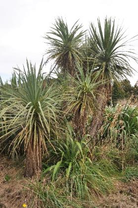
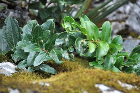
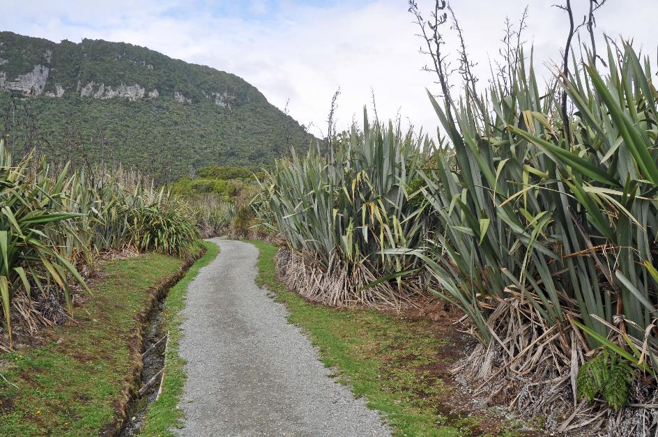
On the rugged coast, especially resilient plants thrive – flax, heather, cabbage tree
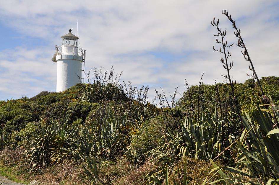
That doesn't prevent us from fully enjoying this rugged piece of nature, where the sun generously showers its rays. In the past, this land was densely forested, but early settlers dealt with that swiftly. Now, grassland dominates, while resilient plants, such as flax, heather, and cabbage tree, persist on the rugged coast. Above all, a gleaming white lighthouse has stood for almost a century.
Tauranga Bay – Wall Island
It's just about an hour's walk to Tauranga Bay. Unfortunately, for us, that's not an option due to time constraints, so we opt for an ultra-short bus ride. We wouldn't want to miss Tauranga Bay for anything.
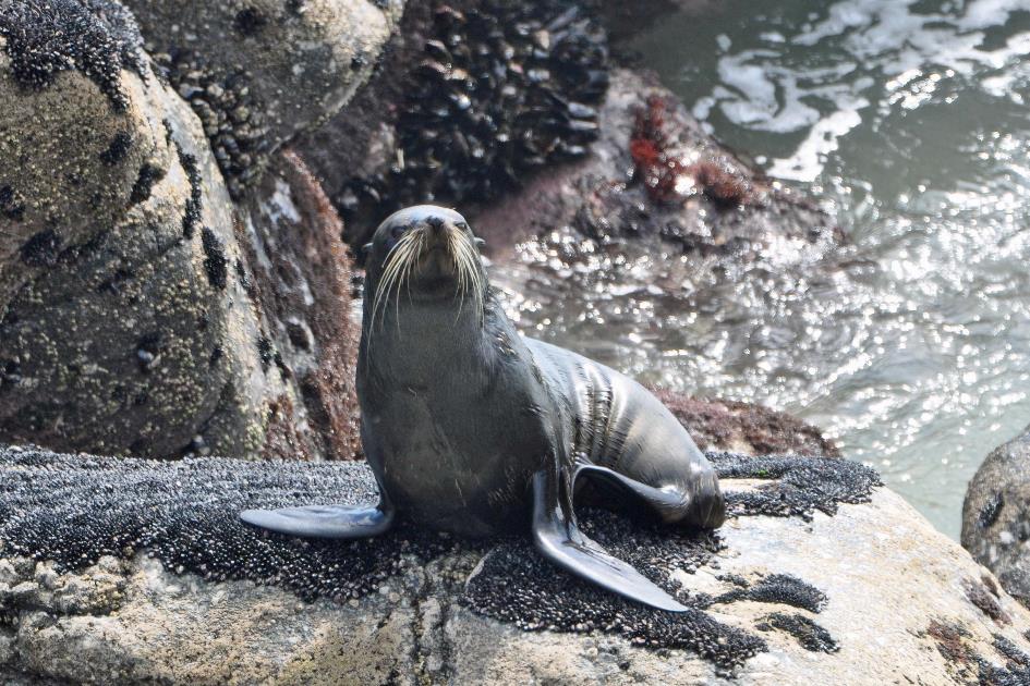
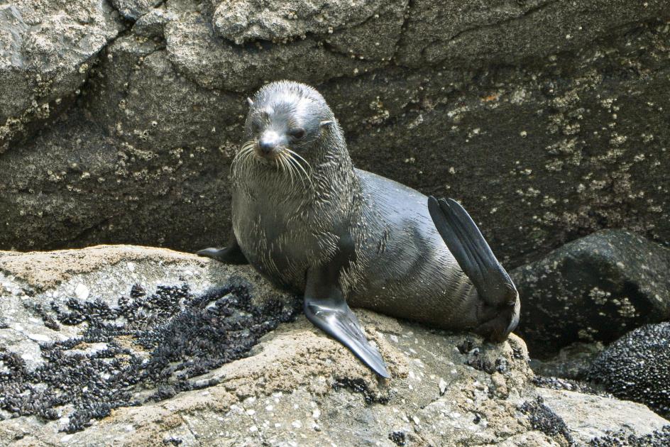
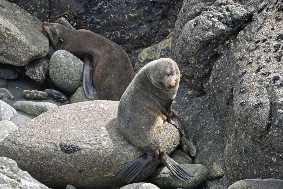
At first glance, there seems to be little difference from the surroundings of Cape Foulwind – wild surf, tough vegetation, rocky islets in the sea. Until strange smells and sounds penetrate our noses and ears. Because for centuries, a colony of New Zealand fur seals has made this place their home.
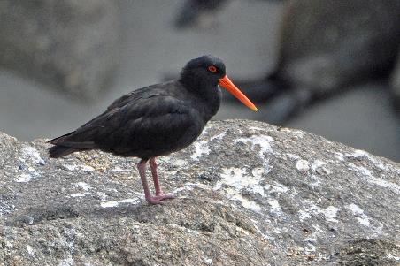
Variable oystercatcher |
|
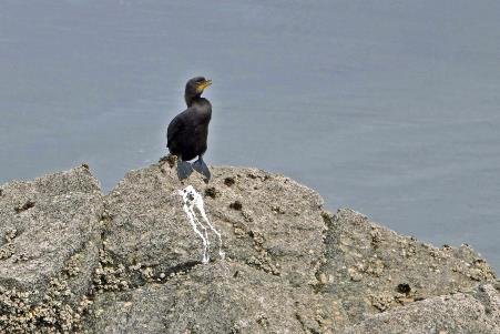
Little black cormorant |
Just like walruses and true seals, these fur seals belong to the informal group of marine mammals or pinnipeds. They mate, give birth, and raise their young on land, but they prefer to frolic in the water. That's where they also obtain their food because their bodies are fully adapted to hunting underwater. They have a menu that includes squid, octopuses, and lanternfish, with blue grenadiers, anchovies, and barracouta – not to be confused with barracuda – easily making their way into their diet as well.
For centuries, a colony of New Zealand fur seals has made this place their home
They primarily swim using their powerful front flippers, while their hind flippers serve as a sort of rudder. They can easily reach speeds of up to 30 km/h and are known to dive three to four hundred meters deep.
On land, manoeuvring with those flippers is, of course, less efficient. However, with fur seals, it's not too bad. Similar to sea lions, they can support themselves on their hind flippers, allowing them to achieve a considerable speed while waddling. In the rocky terrain we are currently overlooking, they could easily outpace a person. True seals, on the other hand, are not nearly as adept at this.
In contrast to true seals, fur seals have a warm, furry coat. They were fiercely hunted for the sake of this fur
And that is not the only distinction between fur seals and true seals. Perhaps the most noticeable difference is the external ears. True seals don't have them, but fur seals and sea lions do. Together, they are sometimes referred to as eared seals.
Another significant difference is their fur. Unlike true seals, fur seals have a warm, furry coat. Unfortunately for these gentle creatures, they were heavily hunted for their fur. Hundreds of thousands were slaughtered. It wasn't until 1980 that this came to an end when fur seals were granted complete protection.
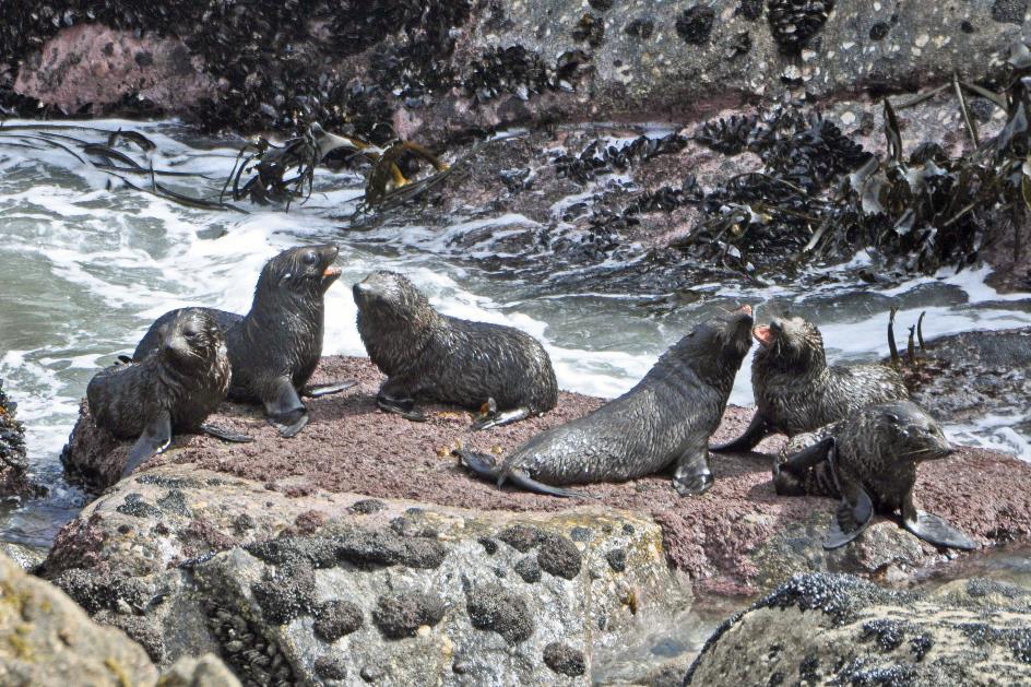
It's the males who first come ashore every year in October. At the beginning of spring, their main goal is to secure a robust territory. Ideally, as close to the waterline as possible, as it attracts the most females. It's almost guaranteed to cause trouble with so many males in close proximity. Fights are commonplace, and sometimes one pays the price with its life.
Barely have the females given birth to a pup, and about nine days later, they are ready to mate again
A month later, the females come ashore. Strangely enough, not to mate but to give birth. They've been pregnant for 51 weeks and first come ashore to deliver their pup, one per pregnancy. Just as soon as that task is completed, about nine days later, they mate again. It's the consequence of having so many eager males in the vicinity.
On land, fur seals can support themselves on their hind flippers, achieving a considerable speed, while true seals, on the other hand, are not nearly as adept at it
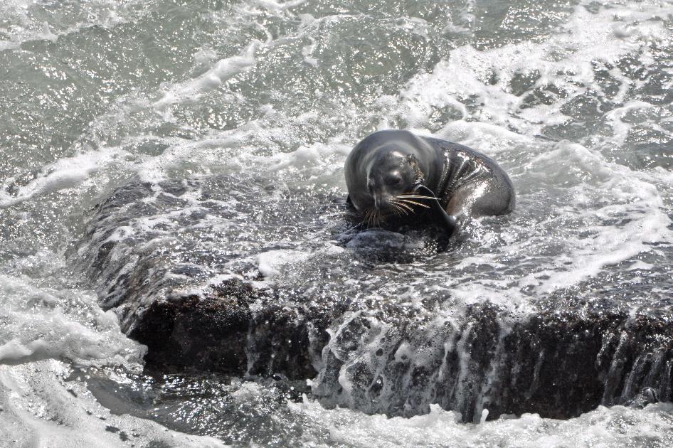
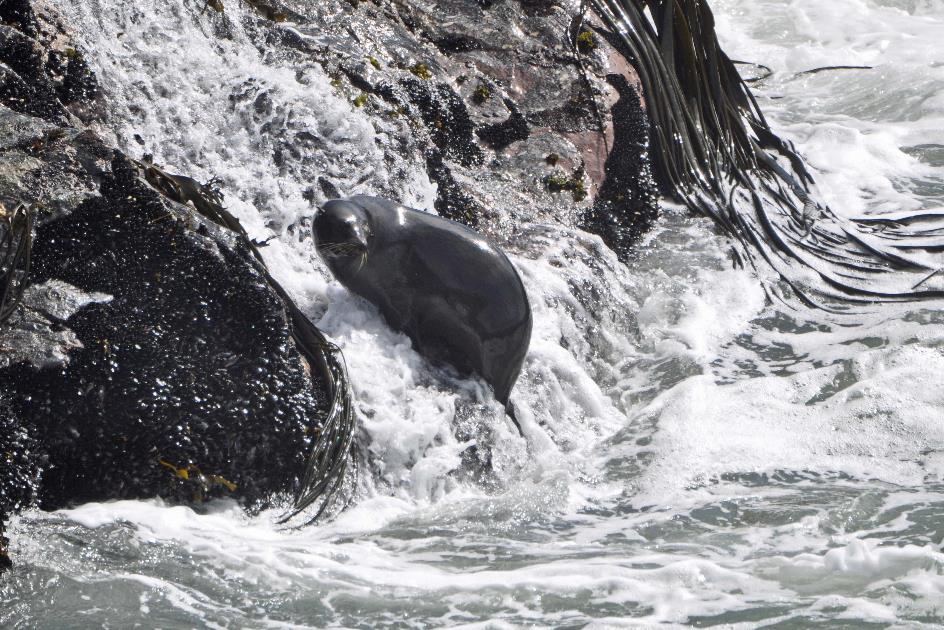
From a platform about ten meters high, we look down on the rocks. At first glance, there doesn't seem to be much happening, but the longer you observe, the more movement you notice. Eventually, there are revealed to be thirty to fifty fur seals, playing in the water, basking on the rocks, or preparing for the hunt. Despite the inhospitable environment, this is a dream habitat for them – close to the water, easily accessible, with many crevices and niches where vulnerable young ones can seek refuge. Birds make their presence known too, such as the familiar kelp gulls and a solitary little black cormorant.
A hundred meters off the coast lies the small Wall Island. It is undoubtedly a safer haven for the fur seals. The nature there is untouched, and the colonization has bypassed the little island.
Playful young fur seals (m)
Here and there, young fur seals are frolicking in the water. Most of them are young males, currently playfully settling their rivalries. Males simply have more time for this, as their bachelor years typically last nine to ten years, while females find themselves burdened with a pup after only five years. Eventually, an adult male seal will come and restore order.
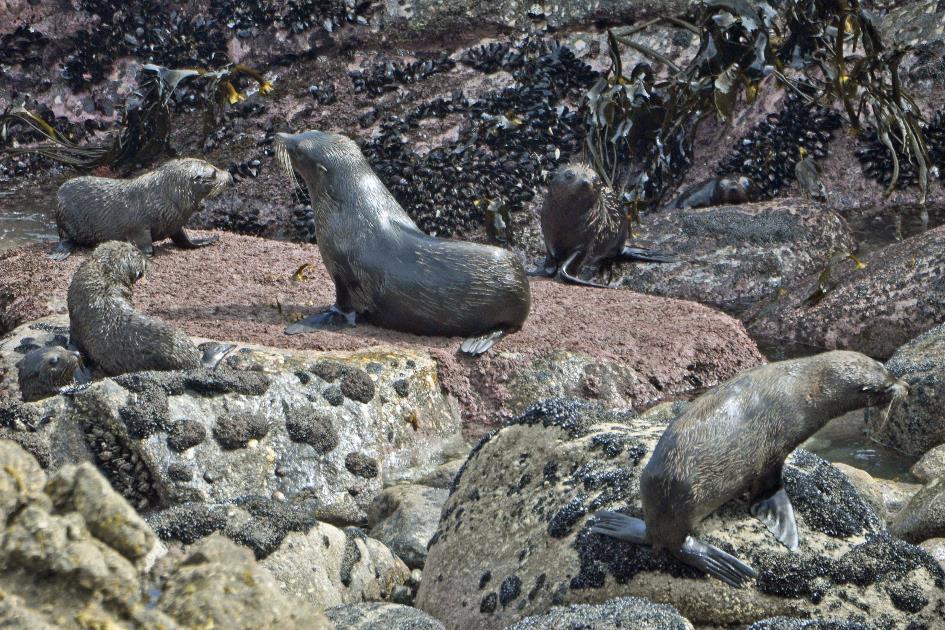
Adult fur seal calls the adolescents to order
One of the pups is trying to befriend a native variable oystercatcher, but the oystercatcher is not interested. A friend who is more than ten times heavier, that's not appealing to it.
A friend who is more than ten times heavier, that's not appealing to the oystercatcher
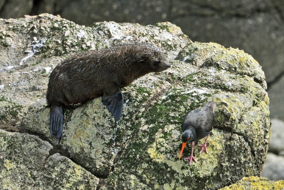
Young fur seal, variable oystercatcher
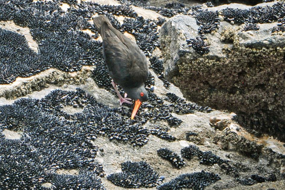
Variable oystercatcher pecks at shells
Meanwhile, it searches for food with its long, red beak, pecking over the rocks. It forages both during the day and at night but never within a two-hour period before or after high tide. When the seawater retreats, it looks for molluscs or crustaceans, as well as worms, small invertebrates, or fish. During the day, it locates them visually, while at night, it uses its sensitive needle-shaped beak to locate the prey.
The oystercatcher likely built its nest somewhere among the rocks. It's typically a primitive setup, not more than a small cavity hidden behind some vegetation. Oystercatcher pairs are monogamous, but their commitment is not for eternity. After a few years, mutual love usually comes to an end.
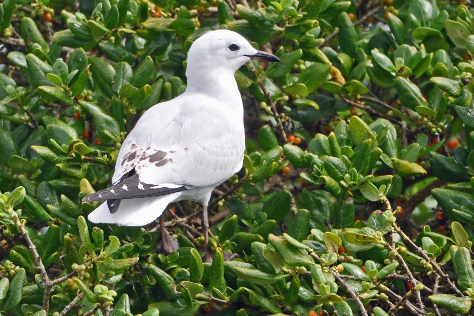
Black-billed gull
Even a black-billed gull briefly makes its presence known. It's a native gull with a silver-grey back and beautiful black wingtips. However, it happens to prefer nesting in river valleys and on beaches – precisely the areas where people often seek recreation. Add some rodents that target its eggs and chicks, and it becomes clear that the black-billed gull is an endangered species.
The Southern Alps, a 700-kilometer-long mountain range, with Mount Cook as its highest point, form the backbone of the South Island
Shortly after three o'clock, we continue our journey southward, heading towards the Southern Alps. This 700-kilometer-long mountain range, with Mount Cook as its highest point, forms the backbone of the South Island. Clouds cling high to the mountain peaks, as if anchored there, waiting to unload their cargo.
As the coastal plain gives way to the mountains, a handful of houses come into view. This small settlement is called Charleston, a symbol of faded glory. Around 1867, Charleston was the epicentre of the gold rush. Thousands of gold prospectors flocked there, especially along the banks of the Nile River, hoping to make the discovery of a lifetime. Hotels, shops, and cafes sprang up like mushrooms. However, by the late 1870s, the hype was over. It's hard to believe that there was once talk of declaring this place the capital of New Zealand.
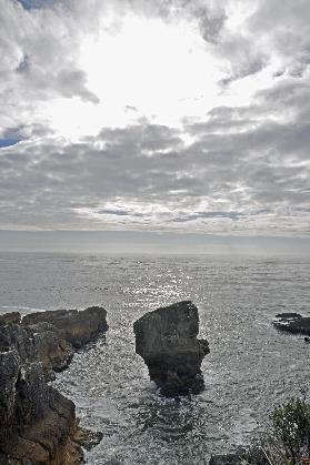
Rocky islets brave the tumultuous surf of the Tasman Sea
|
|
Flax, cabbage tree |
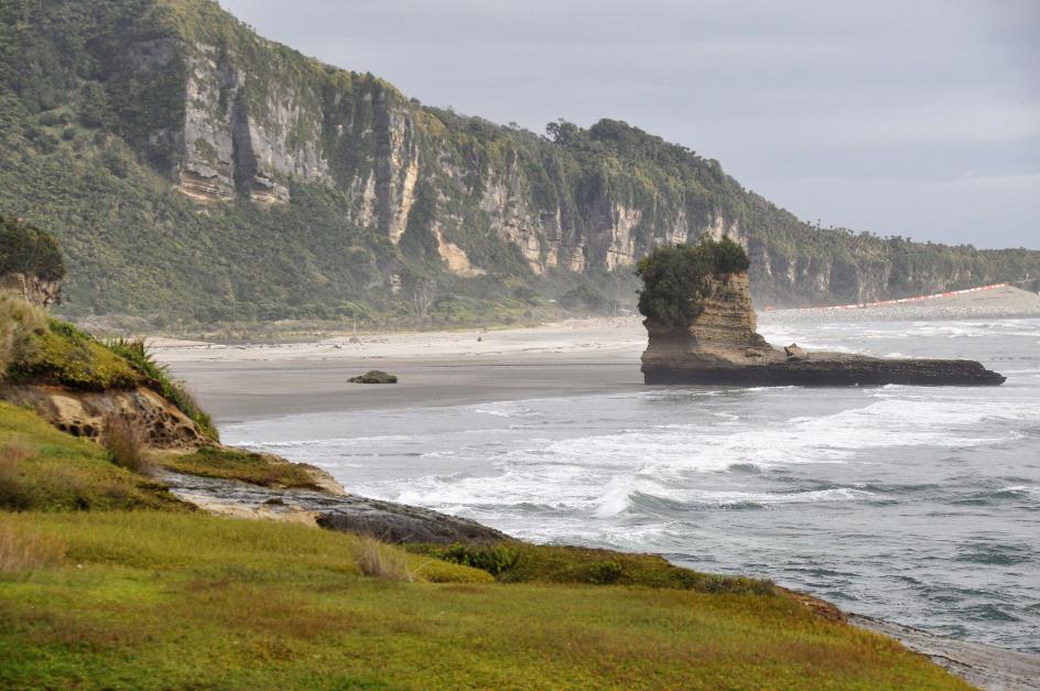
Like a loosely unwound ribbon, SH6 winds its way over the foothills of the Southern Alps until only a narrow strip remains at the base of the mountains, right next to the coast. Rocky islets brave the tumultuous surf of the Tasman Sea. Occasionally, we gaze down at small rocky beaches where the waves die in foaming spray. This often calls for a photo stop, naturally.
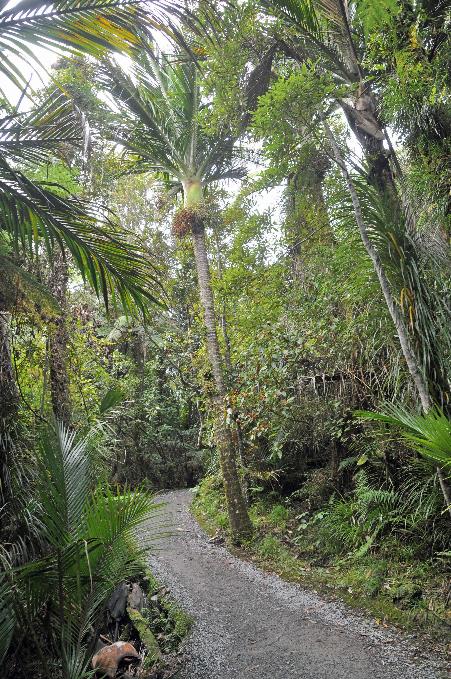
Paparoa National Park
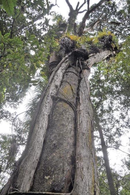
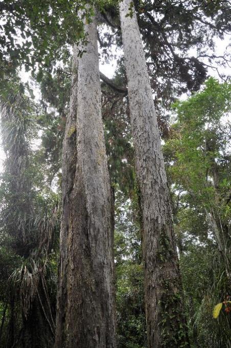
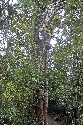
As we delve deeper into Paparoa National Park, a limestone area teeming with karst phenomena, Pancake Rocks is perhaps the most famous among them. But first, we explore the short Truman Track near Te Miko. A beautiful piece of temperate rainforest awaits us there.
Podocarps – the famous needle-less conifers – tower above our heads. Tilting our heads back, we marvel at the straight trunk of a rimu. Its tiny seed cones, about five millimetres in size, are wrapped in a red, fleshy casing, earning it the name red pine. This fellow can grow to be about one and a half meters thick. If you let it live long enough – 800 to 900 years – It can reach a height of fifty meters. The rimu was a welcome guest in the sawmills of the early settlers.
Apparently, a northern rātā has initiated its deadly embrace of the mataī
Northern rātā strangling a mataī |
|
Rimus |
||
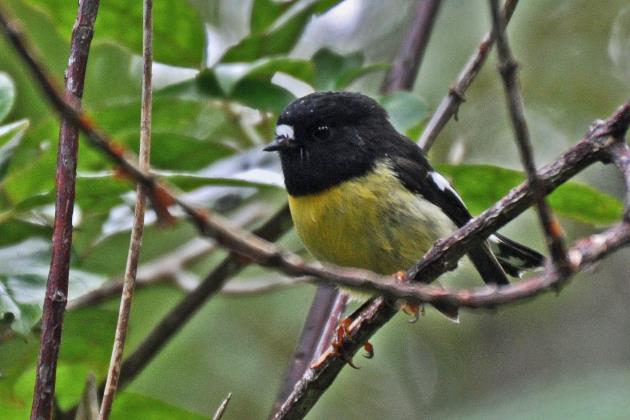
Tomtit |
|
Northern rātā strangling a mataī |
||
Another such straight and hefty tree is the mataī, also known as the black pine. Countless floors in New Zealand homes have been constructed with it, yet its popularity has hardly harmed the species. As a type, it continues to thrive.
However, the mataī we currently observe can't claim the same fate. Apparently, a northern rātā has initiated its deadly embrace of the podocarp. While trees typically assume that their seeds will germinate in fertile soil for reproduction, the northern rātā follows a somewhat different path. It expects birds not to drop its seeds on the ground but rather on high branches of mature trees – preferably with some fertilizer.
The seed then grows as an epiphyte on the host tree, initially without harming it. Meanwhile, the rātā's roots find their way downward. Once they reach the ground, love is over. The rātā's roots will progressively encircle the host tree, eventually strangling it. If we come back here in a few centuries, the mataī will likely have disappeared.
Truman Track |
|
|
It may seem somewhat convoluted, but in these densely overgrown forests, it's the only option to carve out a spot under the sun. The death of one tree is another's chance to survive.
New Zealand flax
Meanwhile, the path has led to an impressive forest of New Zealand flax. These more than man-high green bushes exude a strange charm, so neatly gathered and yet so wild.
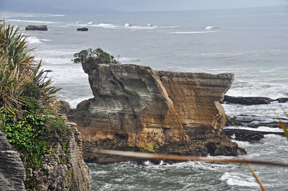
Shoe Island
In the distance, the Tasman Sea beckons. We gaze over the rugged surf that has been shaping this limestone coast according to its own whims for centuries. Scattered rock blocks lie here and there. Sometimes they are actual islands that have resisted erosion for a longer time. One of them, Shoe Island, takes the shape of – how did you guess – a shoe.
But it's the famous Pancake Rocks, about three kilometres away in Punakaiki, that attract all the attention. Or almost all. Because here too, the bad news from Christchurch does not leave hearts untouched. This is evident from the modest tribute to the victims. Near the Visitor Centre, we are invited to lay a flower in the arms of the Nīkau Palm of Peace. We do not hesitate to pay our respects.
Also here, the bad news from Christchurch does not leave hearts untouched
Tribute to the victims of Christchurch |
|
Nīkau palms |
Once again, it is an excellent hiking trail – the Kiwis seem to have a patent on that – that leads us to the coast. In the distance, the sea roars, but we do not see it. Nīkau palms stand photogenically above the dense vegetation.
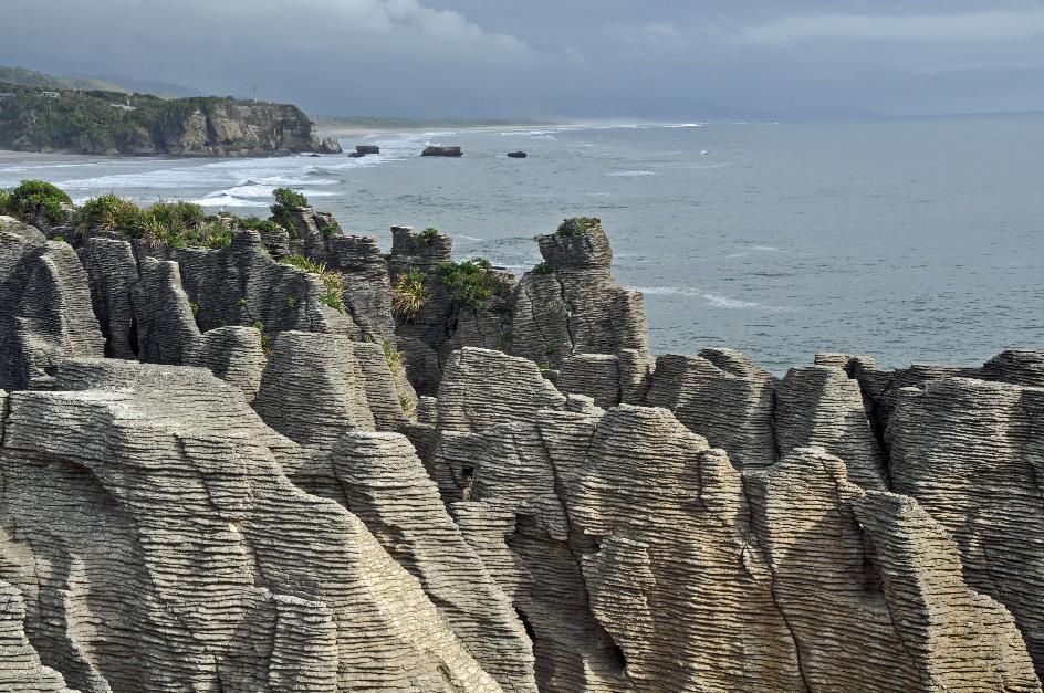
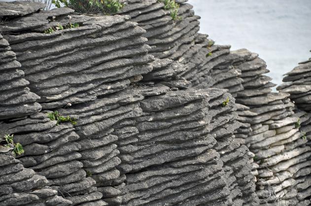
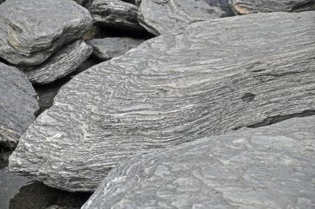
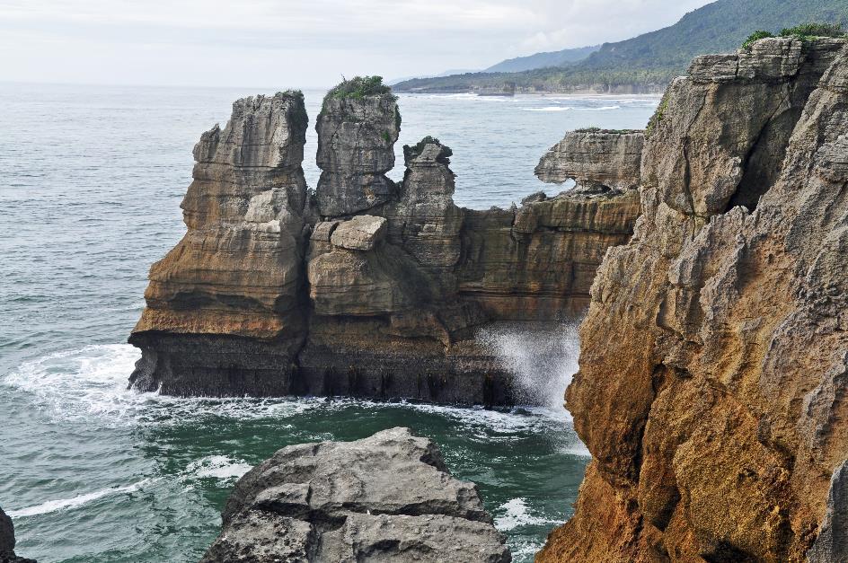
Pancake Rocks
There they suddenly are, the famous pancake rocks. Not just a rock here and there. Literally, you see them everywhere because the entire coastal plateau is built from them. As if a giant decided to stack thick limestone pancakes layer upon layer, hundreds of layers thick, ten to twenty meters high.
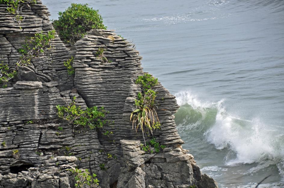
As if a giant decided to stack thick limestone pancakes layer upon layer, hundreds of layers thick, ten to twenty meters high
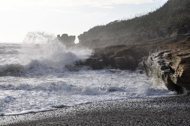
But the surf cannot be subdued. Steadily, it breaches the fragile limestone, for a hundred thousand years. This is how the cavities, the tubes, the blowholes, and the chimneys are formed, which we look down upon.
Limestone rocks in the surf
Roaring, the seawater finds its way through the cracks and tubes in rhythm with the waves, then bursting into clouds of white foam. Each time, it carries tiny limestone particles with it, an ongoing process of erosion that never ceases.
If you let the events unfold for about ten million years, a fairly thick layer of shells forms on the seafloor
The formation of such limestone masses is well known. As is the case worldwide, it is also the work of tiny shell and mollusc creatures here. When they die, they sink to the seafloor, creating a layer of shells. About 35 million years ago, this process must have started in the sea that had formed here at that time. Letting the events unfold for approximately ten million years results in a quite thick layer of shells on the seafloor.
Limestone rocks in the surf
But 25 million years ago, the situation must have changed dramatically. Large amounts of sand and mud from erosion on the land ended up in the sea. There, the sludge sank to the depths, forming a sediment layer. It became thicker and heavier over time. So heavy that it compressed the shells into limestone.
Some time later – about 5 million years ago – tectonic forces began lifting the area. This process is still ongoing, as evidenced by the rise of the Southern Alps. As a result, our limestone mass gradually emerged above the water. Now, erosion could take its course.
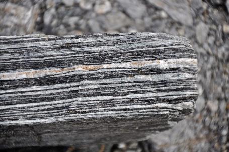
Thick limestone layers alternating with paper-thin mudstone layers |
|
|
But that is, of course, only half of the story. Because our pancake rocks consist of thick limestone layers alternating with paper-thin mudstone layers. How nature managed to achieve this alternation of sediment layers with such regularity and precision over a vast timespan – scientists still have no clue. But that doesn't stop them from giving the phenomenon a name – stylobedding.
It is half-past five when we embark on the short drive to the hotel at the mouth of the Punakaiki River. The sun is still shining in a lightly clouded sky as we arrive. The sea is relatively calm, it is low tide, and substantial portions of the beach are exposed. Even here, they can boast pancake rocks, albeit in miniature.
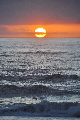
In the west, the copper sun slowly descends into the sea.
|
|
|
Monday, March 18 | Punakaiki – Franz Josef Village
Rain is the norm on the west coast. Four out of five days, you can expect showers. But for now, we don't notice anything. The stars twinkle brightly in the cloudless firmament as we walk the path to breakfast. Just above the eastern horizon, Venus sparkles as the morning star – not to the right, but to the left of the sun, as is customary in the southern hemisphere.
Rain is the norm on the west coast. Four out of five days, you can expect showers
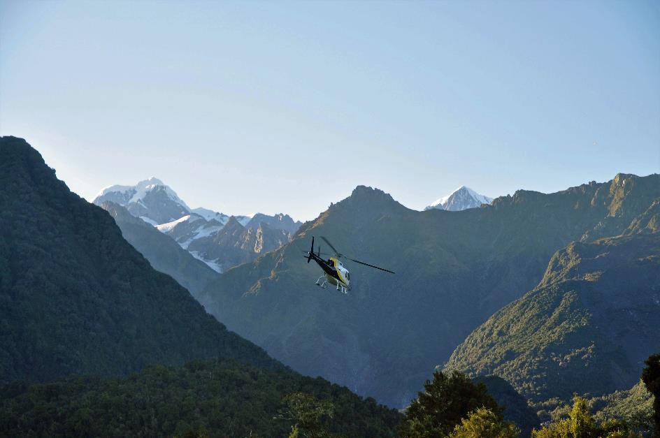
One of the highlights of the trip is approaching today, literally and figuratively. Around noon, we will fly with a helicopter over the Tasman Glacier and the Franz Josef Glacier. New Zealand's highest mountain, Mount Cook, will be almost within reach.
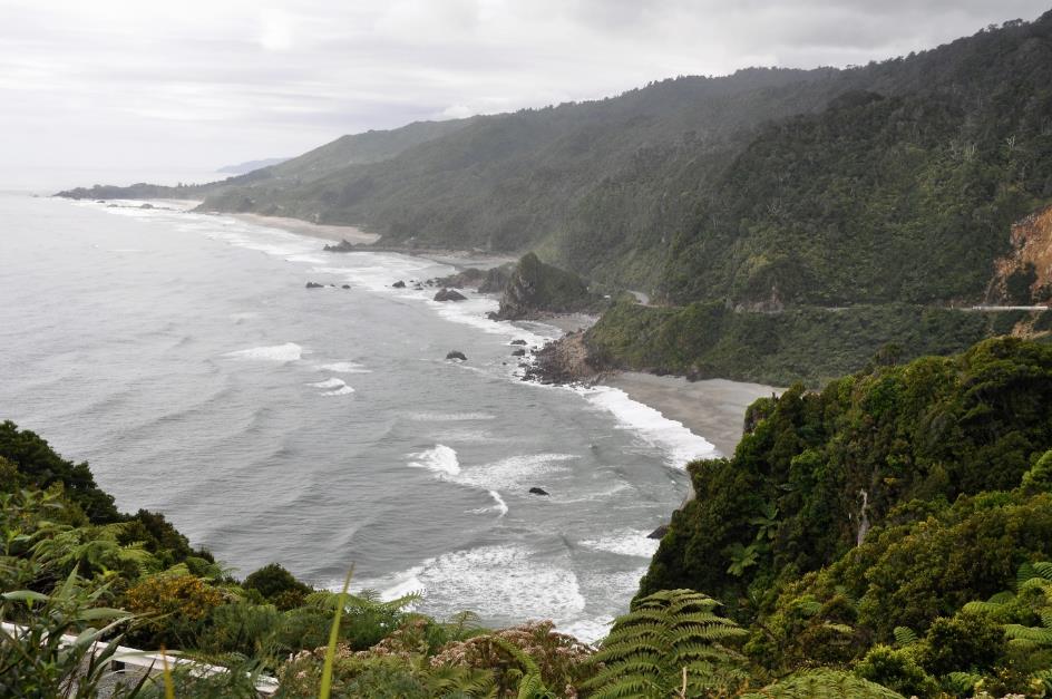
Just after half-past seven, we leave Punakaiki behind. Heading further south, through a landscape that remains the same – mountains on the left, sea on the right – yet continues to surprise with every turn.
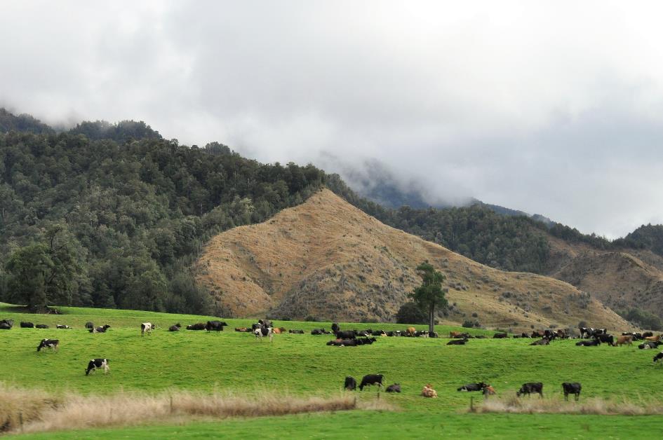
Initially, it's a narrow strip of fertile sediment plain passing by the window. Cows and sheep sometimes graze shoulder to shoulder in the same field.
A thrilling stretch of coastal road follows, winding unpredictably over the green mountain slopes
This soon comes to an end. Near Barrytown, the mountains reclaim their natural place. A thrilling stretch of coastal road follows, winding unpredictably over the green mountain slopes. This provides constantly changing perspectives, snapshots, as it were, of this rugged cliff coast in the morning mist. The waves continuously pound against the rocky coast. Sharp rock points rise menacingly from the seething water. In the distance, the horizon turns purple.
Mists hang low above sleepy Rapahoe. Shortly afterward, we reach Greymouth at the mouth of the unpredictable Grey River. Floods were a regular occurrence here; around twenty have been recorded since 1860. This ended in the late last century when a decisive mayor had a sturdy Flood Wall built along the river.
This calamity did not prevent thirteen thousand Kiwis from settling in this district. It makes it the largest city on the West Coast. Almost half of the West Coast population clusters here.
Gold played a significant role here in the 19th century, as in many of these coastal towns. However, it is primarily the black gold that determines the economic life in Greymouth. Around 1850, coal was discovered in the Grey Valley. Many went to work in the coal mine.
Twenty-nine miners lost their lives, their bodies were not recovered
It was a severe blow to this community when on November 19, 2010, methane gas exploded in the mine. Rescue teams were powerless because there was too much methane gas present. After three more explosions, all hope was abandoned. Twenty-nine miners lost their lives, their bodies were not recovered. Only the following month, on May 21, the first rescuers descended into the mine to search for bodies and the cause of the explosions. The Pike River Memorial recalls those tragic events.
The morning mists persist; the sun has not succeeded in dispersing them yet. We don't mind; it provides us with poetic scenes of shadowy sheep in green meadows.
At quarter to nine, the Town Clock of Hokitika emerges from the mist. This monument aims to keep alive the memory of an episode nowadays considered controversial – the contribution of New Zealand soldiers to the British fight against South African farmers.

Hokitika – Town Clock

Solidarity with all Muslim whānau
But today, it's different victims who are in the spotlight. With banners and flowers, the local community expresses its love and solidarity with all Muslim whānau – a term encompassing all Muslims who are part of the large family that New Zealand truly is.
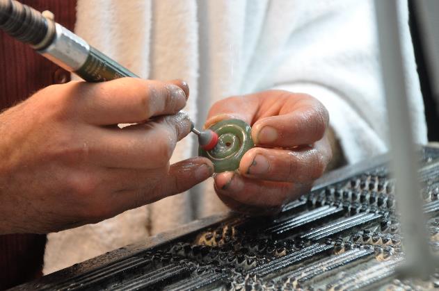
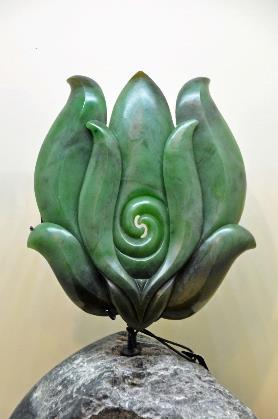
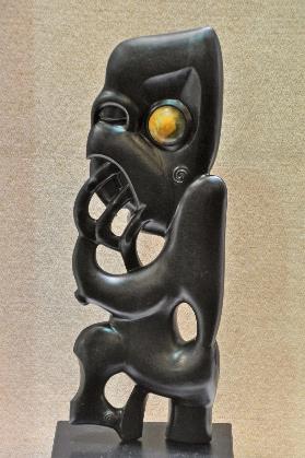
In the 21st-century Hokitika, it's not the black gold that takes centre stage but the green gold. Only here on the west coast can you find pounamu, the famous green stone that plays such a significant role in Māori culture. The South Island even owes its official Māori name to it – Te Waipounamu, Place of the Green Stone.
Only here on the west coast can you find pounamu, the famous green stone that plays such a significant role in Māori culture
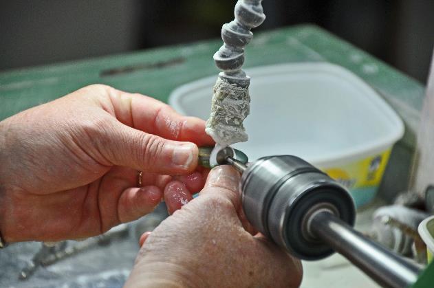
Processing pounamu |
|
|
||
|
|
Processing pounamu |
||
In most cases, pounamu consists of nephrite, a metamorphic rock that formed deep in the earth under immense pressure and high temperatures. This happened quite a long time ago – somewhere between 100 and 300 million years. It was only five million years ago that this precious material began to gradually emerge to the surface. The same tectonic forces that lifted the Pancake Rocks and the Southern Alps were behind this. That's why you find pounamu exposed high in the mountains, but also under the debris carried by glaciers, on the banks and in the beds of mountain rivers, and even on the coast, where it has been uncovered by the erosion of the sea.
At Mountain Jade, they know all about it. In the shop and workshop, we can explore an extensive range of artworks crafted from green stone. But first, some explanation is in order because not all pounamu is the same, we learn. There are different types.
The apple-green, translucent kahurangi is generally considered the highest quality pounamu
Kahurangi |
|
Braiding river |
There is the dark, less expensive South Westland, which contains a bit more iron. The greyish-yellow kōkopu stands out with its peculiar spots in the stone, while the fairly dark kawakawa resembles the leaves of the shrub with the same name. And not to forget, the apple-green, translucent kahurangi, which is generally considered the best quality.
Mist still dominates as we continue our journey around half-past nine. No trace of sea or mountains is visible, and cows are reduced to misty shadows in the meadows. This doesn't bode well for our helicopter flight later.
Gradually, things start to change. It gets a bit warmer, enough to evaporate the droplets in the atmosphere. The mists dissipate, but fortunately not entirely. Finally, we get to see them, the long white streaks of mist that are so typical for this island. They drift high against the green mountain slopes, gracefully and unapproachable. New Zealand even owes its Māori name to them – Aotearoa, the Land of the Long White Cloud.
Ross has a population of three hundred. The small settlement along the coast originated around 1865 during the gold rush and was mostly abandoned barely ten years later – a story we've heard before. The difference here is that they did indeed make the find of a lifetime afterward. In 1909, a gold nugget weighing a whopping 3.09 kg was unearthed. Today, you would have to cough up about € 114,070 for it. They named the treasure Honourable Roddy, with a nod to Roderick McKenzie, the then Minister of Mines.
Nowhere else in the world will you find glaciers so close to the tropics that reach sea level
The discovery could not have come at a better time. When King George V of England was crowned in 1911, New Zealand had a beautiful gift ready. Forty years later, the Kiwis discreetly inquired about the whereabouts of their Honourable Roddy. It turned out the nugget had been melted down into a royal tea set.
Meanwhile, there's no sign of mist. Occasionally, the sun even manages to break through the clouds. We realize that we are slowly approaching glacier country as we cross the azure blue water of the Wanganui. Such water is called glacier milk, containing fine rock powder suspended in it. This powder comes from rocks that the glacier has ground down into small particles, similar to peppercorns in a mortar.
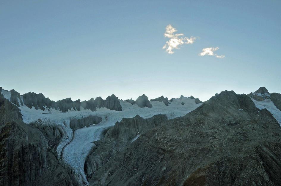
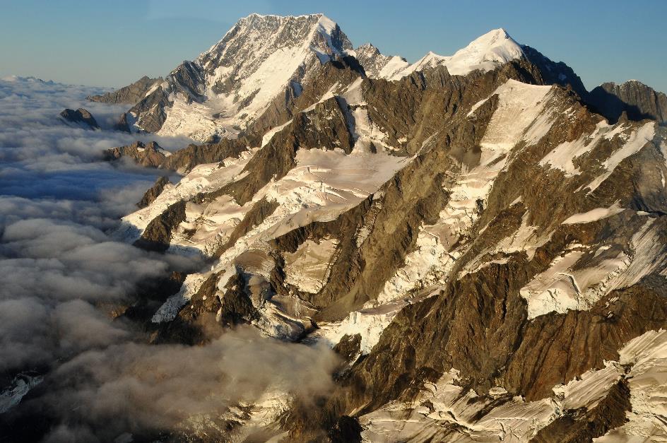
Indeed, the Westland National Park has no shortage of glaciers. There are more than sixty spread over an area of 1,320 km². The most famous ones are the Fox Glacier and the Franz Josef Glacier. They owe their fame mainly to their easy accessibility. Once upon a time, these glaciers even flowed into the sea. Nowhere else in the world will you find glaciers so close to the tropics that reach sea level.
Whataroa
The winding road takes us over a ridge to the glacier valley of Whataroa. The massive riverbed, two to three hundred meters wide, is mostly dry. Through the grey sand, the sparse water finds its way to the sea via shallow channels. Like strands of a braid, they continuously intersect, forming a network of little rivers – a typical example of a braiding river.
Even on this quiet road, nature proves to be a formidable force a little later. Over a length of about four hundred meters, a landslide has thoroughly disrupted the road surface. It sometimes happens that the road is completely impassable. That's a small disaster because you then have to detour for many hundreds of kilometres.
In a corner of the sediment plain, Lake Wahapo marks the beginning of the Westland National Park. This is our first kettle lake, essentially a dead-ice hole. These lakes form when a glacier retreats, leaving behind a colossal block of dead ice. Melting water released from the glacier surrounds the ice mass and deposits sediment. This creates, in essence, an earthen wall around the ice. When the ice eventually melts, a depression remains, at most ten meters deep, filled with rainwater.
Upstream, we now follow the Ōkārito. This dark brown river turns out to drain Lake Mapourika, the largest kettle lake on the west coast, five kilometres long. While the blue-green Lake Wahapo receives a lot of meltwater, this kettle lake has to contend with tannin-rich rainwater from the nearby forests, hence its deep brown colour.
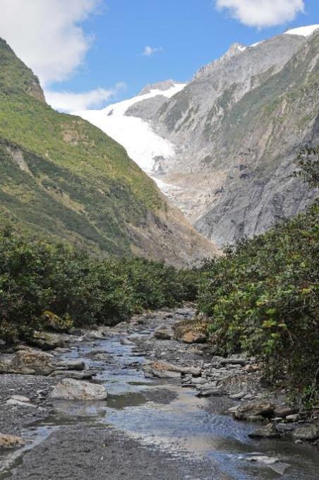
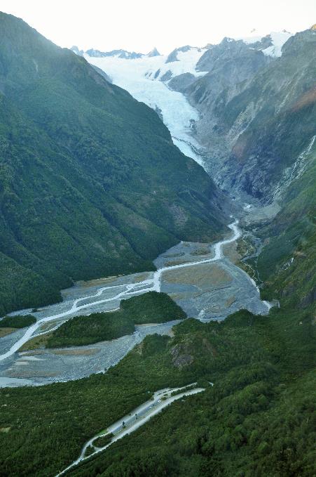
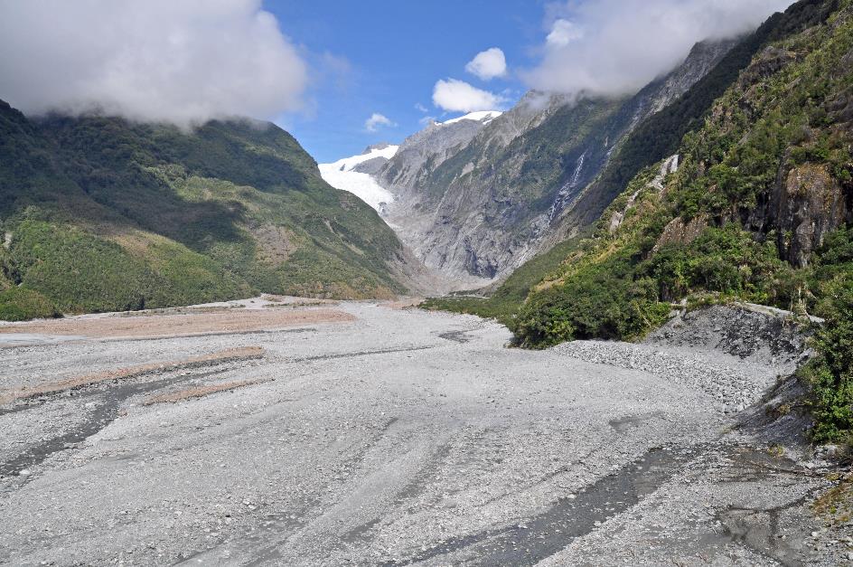
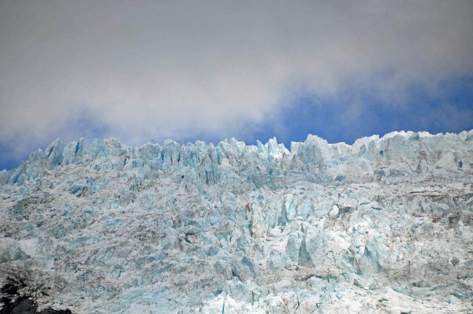
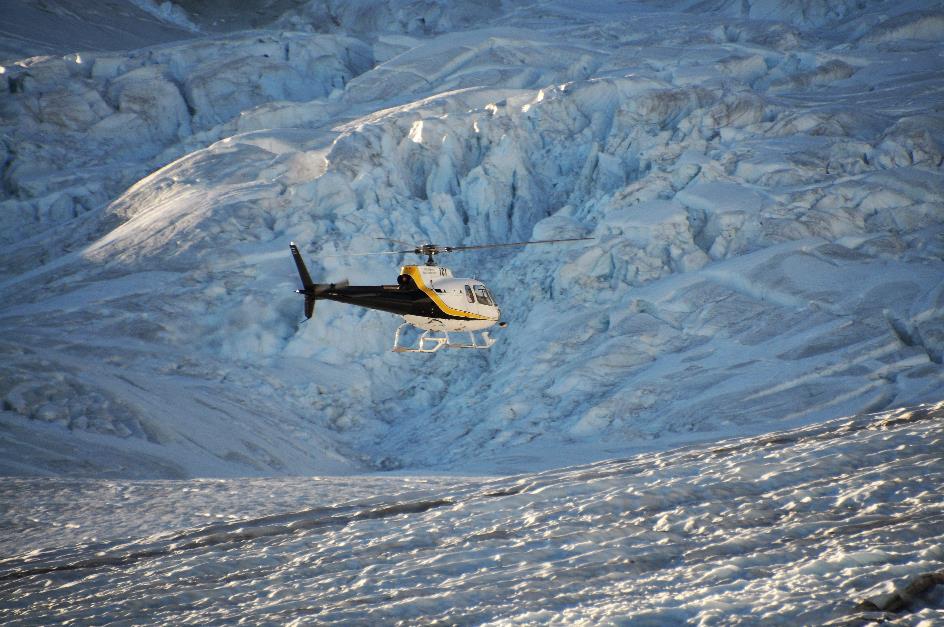
Finally, there it is. Peeking through trees and mountain peaks, we catch our first glimpse of the Franz Josef Glacier, the fourth longest glacier in New Zealand. Shortly after, we are at Franz & Fox Heliservices, eager with anticipation. High among the mountain peaks, it turns out the weather is ideal for our flight.
Peeking through trees and mountain peaks, we catch our first glimpse of the Franz Josef Glacier
So far, the good news. The bad news is that the weather conditions in the lower airspace make the flight impossible. And you don't mess around with that. In 2015, an AS350 Squirrel helicopter crashed between the crevasses of the Fox Glacier. The pilot and six tourists lost their lives. The weather conditions were such that the flight should never have taken place, it was concluded later.
A new attempt is already scheduled in our agendas, tomorrow morning at eight. It's not the end of the world, as there is much to explore in the surroundings of Franz Josef Village, a lot indeed. For a quick bite, we head to the Full of Beans café. That name means lively, energetic, full of vitality, we are told.
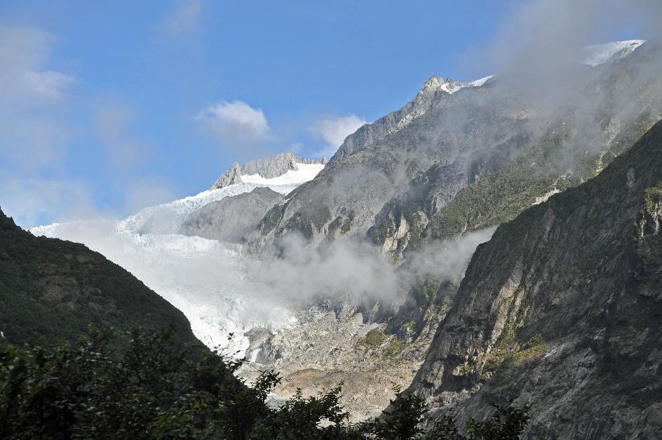
Energy and vitality, that's exactly what we need. Just before two, Harry and Krsto are waiting for us at Glacier Base for a vigorous walk to the Franz Josef Glacier. It will be a remarkable hike because nowhere else in the world can you take such a walk – from among palm trees to a glacier. Ice in the Rainforest – that's how they promote it, with a bit of exaggeration.
A rickety bus of Chinese make takes us to the starting point of the hike. Franz Josef Village has just under three hundred inhabitants, says Harry, but every season, about a million visitors flood the town. To cope with this annual invasion, this small village has three thousand beds ready.
The gas station of Franz Josef Village is probably the most expensive in New Zealand
That the Southern Alps are being thrust upward by the collision of tectonic plates, we already know. This process has been ongoing for fifty million years, and in the last five million years, it has shifted into a higher gear – 10 to 20 mm per year, to be exact. However, Harry adds right away, it's actually a reverse subduction. Because here, it's not the Indo-Australian Plate pushing the Pacific Plate downward. Instead, it's the Pacific Plate sliding over the Indo-Australian Plate – obduction, in other words. The tipping point between these two movements is located at Marlborough Sound, the northwest corner of the South Island.
Volcanic eruptions are no longer a concern on the South Island, but earthquakes are. The gas station passing by the window is probably the most expensive in New Zealand, according to Harry. Because it sits right on a fault line, it must be extra secure against the inevitable earthquake. On average, every three hundred years, an earthquake with a magnitude of 8 on the Richter scale occurs here. The most recent one happened just 300 years ago, he grins.
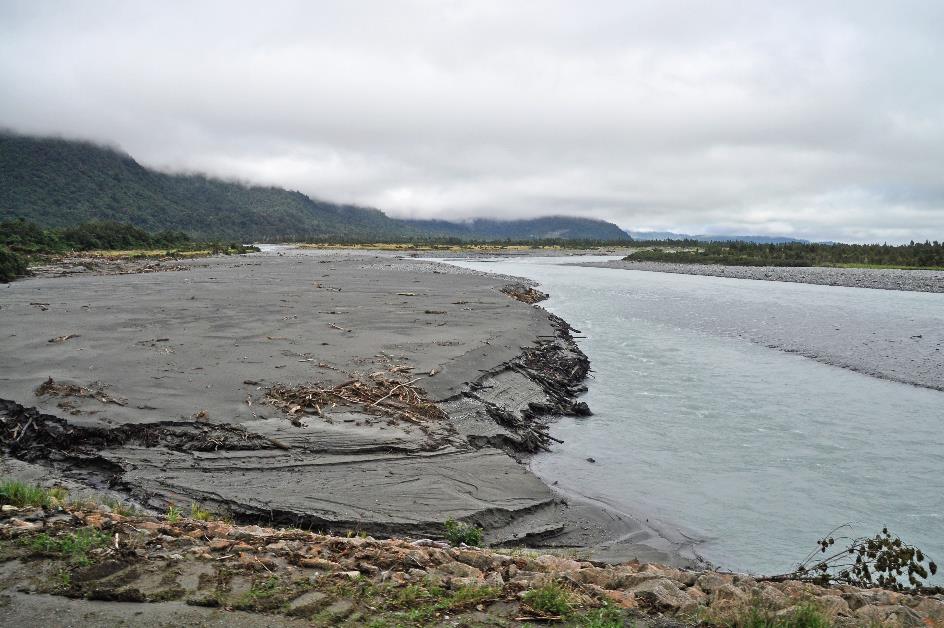
Upstream, our bus follows the Waiho, the river that drains the meltwater from the Franz Josef Glacier. Currently, the wide riverbed is mostly dry, but that can quickly change. Especially heavy rains can rapidly increase the water flow. Franz Josef Village receives 5,100 mm of rain annually.
Little do we know that a flood would destroy this bridge exactly one week from now
The narrow one-lane bridge over the Waiho, about a hundred and fifty meters long, spans a sandy riverbed where hardly any water flows. Quite innocent, it seems. Little do we know that exactly one week from now, a flood will destroy this bridge. From Sunday to Tuesday, a total of 400 mm of rain will fall here. The flow of the Waiho will swell so much that large parts of the bridge will be swept away.
In a record time of just eighteen days, the Kiwis will repair the bridge. But during all that time, the SH6, the only road along the west coast, will be interrupted. Driving further south from Franz Josef Village to Fox Village, as we will do tomorrow, will be impossible. You will have to take a detour around the Southern Alps – an exorbitant route of 988 km via Hokitika, Arthur's Pass, Geraldine, Wanaka, and Haast.
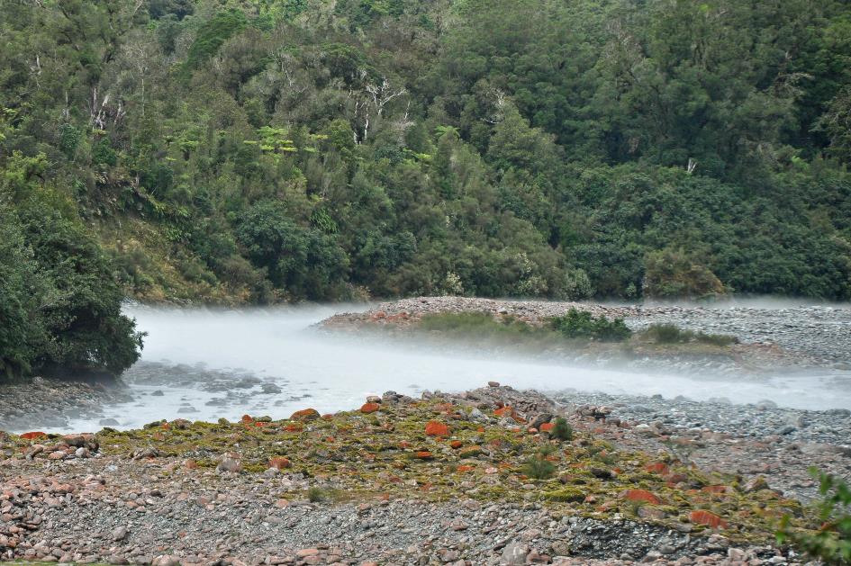
Franz Josef Glacier – Waiho or ‘Smokey River’
Smokey River, they sometimes call the Waiho. That's because of the mist that hangs low above the river. Harry attributes it to the condensation of water vapour in the air, just above the icy river water, which maintains a constant temperature of 2 °C (36 °F).
The forest of podocarps on our right, Harry calls a Jurassic forest. That's not even an exaggeration, he thinks. After all, that forest hasn't fundamentally changed since Gondwana separated from Laurasia. Such forests have been here for more than 160 million years.
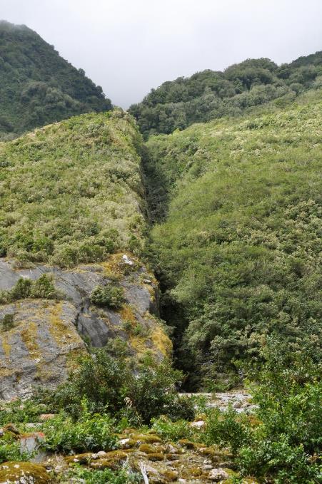
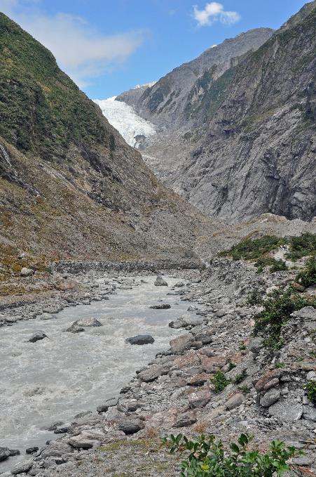
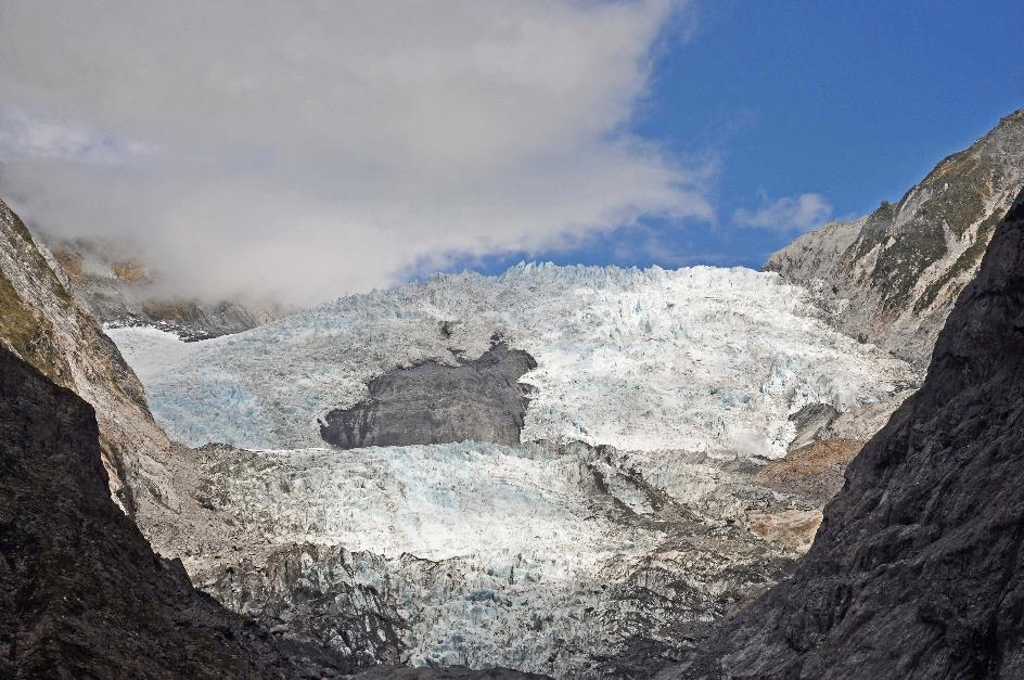
As we penetrate deeper into the valley, the trees and shrubs will become smaller. The explanation is straightforward – the higher up the valley the plants are, the younger they are. As the glacier continues to retreat, more and more terrain is exposed. One hundred and fifty years ago, the glacier reached the parking lot where the bus drops us off. Nowadays, it's almost a three-kilometre walk from the parking lot to the glacier tip.
A hundred and fifty years ago, the Franz Josef Glacier extended almost three kilometres further
Our Franz Josef Glacier Walk will not take us that far. In two groups, led by Harry and Krsto, we will venture along the turbulent Waiho, climbing through the moraine of the glacier until we reach about 750 meters from the glacier's tip.
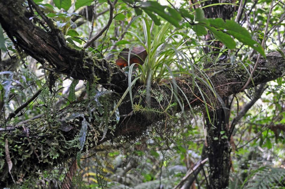
However, it won't be just a trek through a barren rocky desert. Harry promptly leads us into a compact piece of rainforest. So, it is true after all – rainforest and glacier coexist side by side here.
In this humid, shaded forest, close to flowing water, the kiwikiwi thrives excellently. It is an endemic fern known to the Māori for its excellent remedy against toothache.
The mouku also flourishes here. The leaves of this native fern are edible. What makes it particularly interesting are the brood bulbs on the veins of the leaves. These are essentially fully formed mini plants with everything they need. Kiwis call this fern the Hen and Chicken Fern because of this – simultaneously hen and chick. Once the brood bulbs are large enough, they fall to the ground to grow into mature ferns. This form of vegetative reproduction is more efficient than traditional spore formation.
So, it is true after all – rainforest and glacier coexist side by side here
|
|
|
Not only ferns are abundant here but also epiphytes – plants that grow on tree trunks without harming their host. The frequent rains are responsible for this abundance. One might feel more like being in the tropics than on the moraine of a glacier. However, life is not easy for these plants here. Extreme temperatures constantly alternate in this valley – from scorching hot to freezing cold.
High on the slope on the opposite side of the valley, Harry points out a forest of tall trees. Lower down the slope, only small trees dominate. The explanation is always the same – the vegetation at the bottom of the slope is more recent because, roughly a century ago, the glacier's ice reached much higher.
|
|
Waiho |
We continue our ascent through the bed of a swiftly flowing stream, narrowly avoiding getting wet feet. Bits of mica sparkle in the mud. Harry calls it fouls gold because gold prospectors were sometimes deceived by the glimmer of these minerals, thinking it was gold.
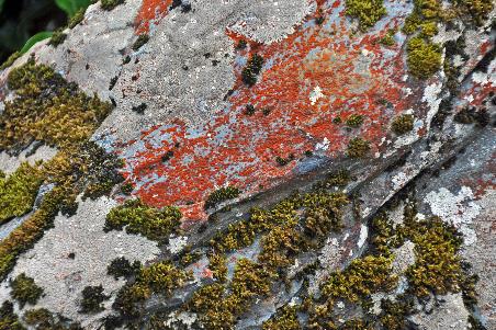
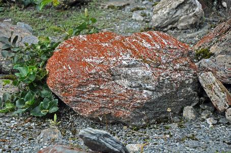
When a glacier retreats, pioneer plants gradually take its place. First among them are the trentepohlia, the brown-red patches on the rocks
Trentepohlia |
|
|
When a glacier retreats, pioneer plants gradually take its place. One of the first colonizers of the rocky terrain is trentepohlia, the brown-red patches we see on many rocks. In fact, these are green algae. They use sunlight for photosynthesis through their chlorophyll, just like green plants. The reason they don't appear green, as plants typically do, but rather brownish-red, is due to an abundance of carotenoids. This is similar to how flamingos turn pink due to the beta-carotene in the shellfish they consume.
|
|
|
|
|
|
After the trentepohlia, mosses and lichens gradually start to colonize the terrain. It takes a bit longer for larger plants to establish themselves. For example, in about thirty years, we will encounter the poisonous tutu plant here, the one we learned about in Zealandia with Don. If we come back in about a hundred years, a forest will undoubtedly have taken root here.
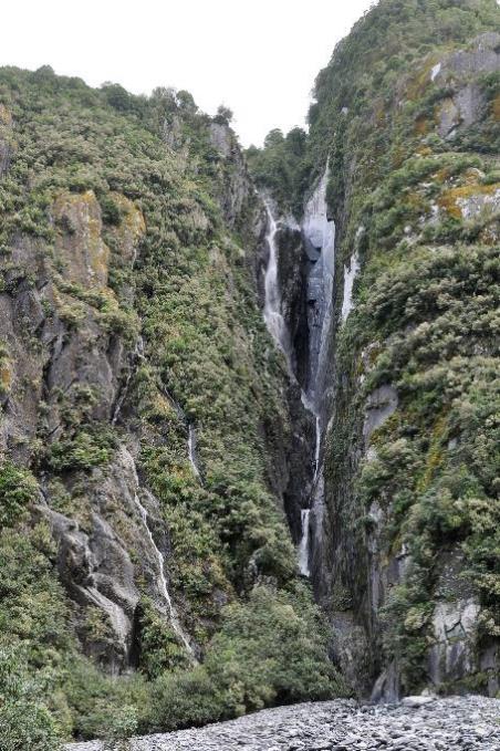
A distinct fault line in the mountains is clearly visible on both sides of the valley, and it continues beneath our feet, according to Harry. That's a reassuring thought, crosses through our mind.
Fault line... |
|
...with a waterfall |
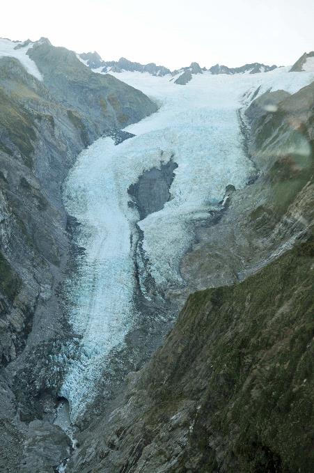
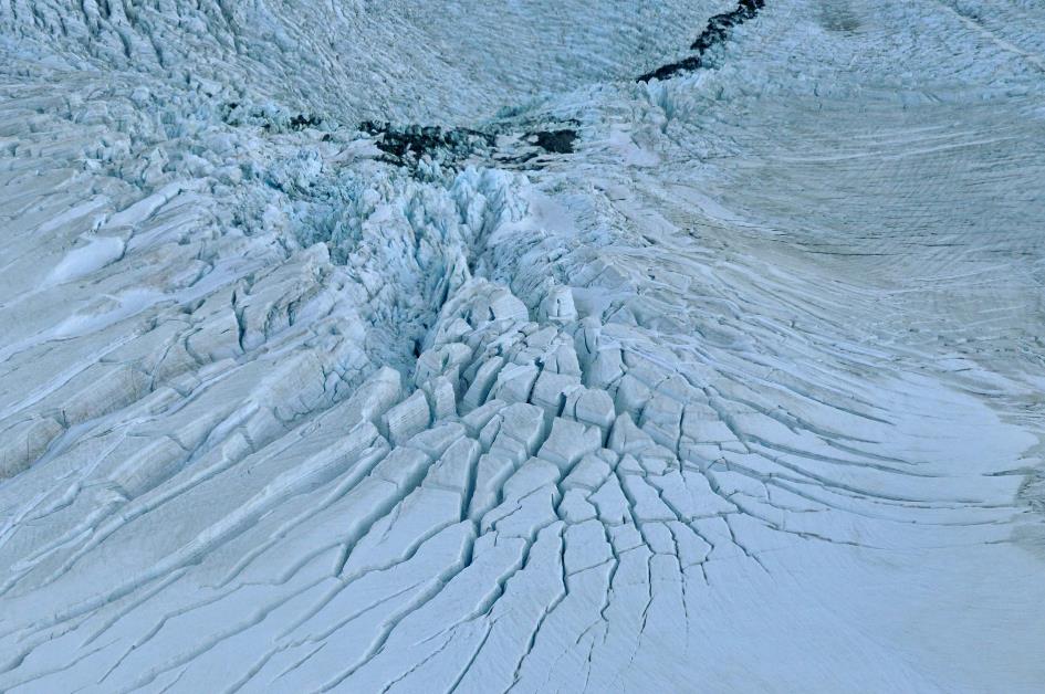
Here and there, ice blocks gather on the banks of the Waiho. They are forty years old, having completed the entire journey from top to bottom. This is, of course, the fundamental principle of every glacier. At the top, new snow continuously falls – in the case of the Franz Josef Glacier, it's ten to fifteen meters per year. Under pressure, this snow turns into ice, and due to gravity, that ice slowly slides down the slope. At the bottom, the ice then melts away.
If we were to return in a hundred years, there would undoubtedly be a forest here
Waiho |
|
Franz Josef Glacier |
The question that every glacier continually asks itself is, of course, whether its balance is positive. In other words, is there more snow falling at the top than the amount of ice melting at the bottom? Or is it the other way around?
Regarding the Franz Josef Glacier, its balance is negative in the long term. However, this glacier is known for its rapid response time. Changes in temperature or precipitation have consequences for its length within three to four years. This has led to short periods of growth in the past. The last time this happened was between 2004 and 2008 when the glacier grew by 280 meters.
But overall, the balance is negative. While the glacier was over 13 km long in 1893, today it is only 10.47 km. Since 2008, it has even shrunk by eight hundred meters.
The question that every glacier continually asks itself is, of course, whether its balance is positive
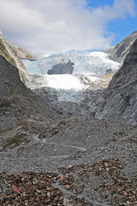
Glacier front with seracs
However, questions can also be raised about this analysis because, in reality, these glaciers originated from a heart-wrenching love story. At least that's what the Ngāi Tahu, the local Māori tribe, claim.
Hine Hukatere, strong and fearless, had a passion for climbing mountains. One day, she managed to convince her beloved Tūawe to join her in her climbing adventures. In truth, Tūawe wasn't particularly fond of climbing – it wasn't his forte – but when your loved one asks you to, you simply do it. It's as simple as that.
The Franz Josef Glacier is known for its rapid response time. It reacts within three to four years to fluctuations in temperature or precipitation
As is customary in legends, tragedy struck. Tūawe was caught in an avalanche and tumbled down. The place where this happened has been called Te Moeka o Tūawe, the Bed of Tūawe, by the Māori ever since. We know that place as the Fox Glacier.
Naturally, Hine Hukatere was inconsolable, shedding tears in abundance. Her infinite grief did not go unnoticed by the gods. They decided to freeze her tears as an eternal reminder of her heartbreak. Therefore, Kā Roimata o Hine Hukatere is the name the Māori give to the Franz Josef Glacier, translating to the Frozen Tears of Hine Hukatere.
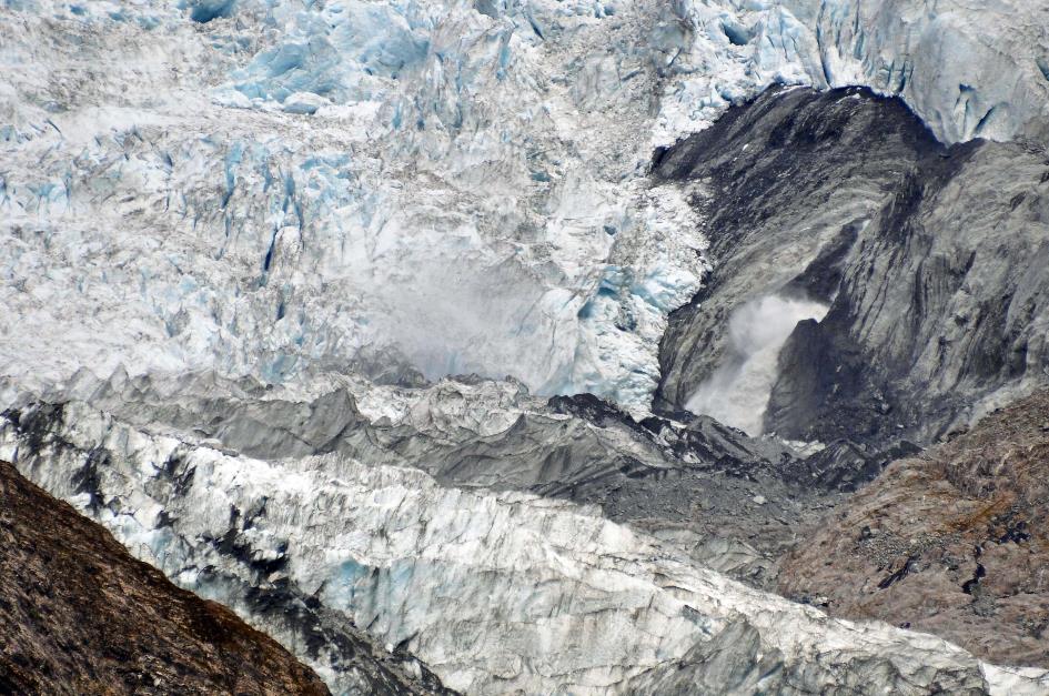
Meltwater sprays from beneath the glacier (on the right)
From a distance of about 750 meters, we now gaze upon these frozen tears. The sun is still shining brightly, despite the numerous impurities, casting a radiant glow on the white ice mass. Massive ice towers or seracs stand out sharply against the deep blue sky in intricate formations. On the right, meltwater gushes from beneath the ice mass.
That New Zealand continues to attract migrants, Krsto is living proof of
Just after four o'clock, we turn back. Along the way, we learn that New Zealand continues to attract migrants, and Krsto is living proof of that. Born in 1975 in former Yugoslavia, his decision was made in 1991 when a civil war broke out in his country – he would emigrate. However, it took almost a quarter of a century to gather enough money for that endeavour.
Two years ago, the time had finally come. With his wife and three children aged five to ten, he took a single flight to New Zealand – only two thousand euros for five people. But you had to go through some challenges for that. Their journey started from Zagreb, passing through Amsterdam, Bangkok, Taipei, and Sydney before reaching Auckland.
The only possessions they had upon arrival were the suitcases they brought with them. They had no job, and nowhere to stay. Quite daring, we think, for someone in their forties with three children. He shrugs. Age doesn't matter. His wife found a job as a software engineer almost immediately. For now, he works as a guide, hoping to find a proper job soon. Ending up like his parents, who will die in that backward country, was not an option for him.
Tuesday, March 19 | Franz Josef Village – Fox Village
Dawn above the Southern Alps
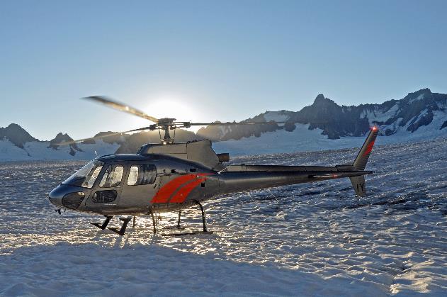
The six of us climb aboard a Eurocopter AS350 Squirrel. So, our Grand Tour above the glaciers is a go after all. A call from Fox & Franz Heliservices was enough to dispel any doubts about the weather conditions.
It's exactly eight o'clock when pilot Jimmy lifts his helicopter into the air with roaring rotors. The mists over the rivers and meadows are far from cleared. However, the mountain peaks and glaciers are cloud-free. In the east, the sun makes its way across the sky, determined not to give clouds a chance.
Franz Josef Glacier – Terminal Moraine |
|
Franz Josef Glacier with nunatak |
Not a minute later, we hover above the terminal moraine of the Franz Josef Glacier. Below, the Waiho rushes between the rocks. Hikers are still absent at this early hour.
Dawn over the Southern Alps
Behind the jagged ridge, the last remnants of morning red vanish
Mount Tasman and Mount Cook
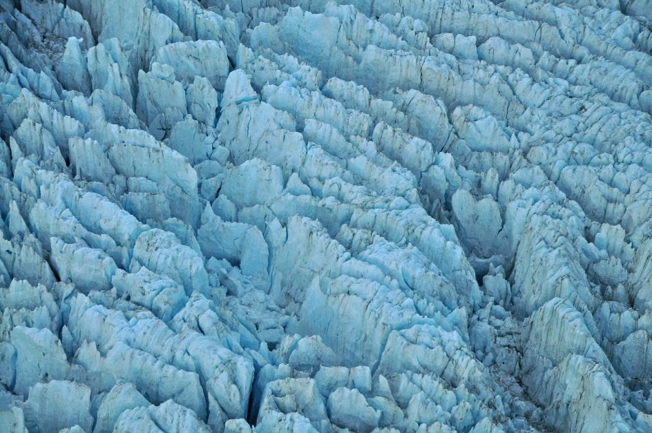
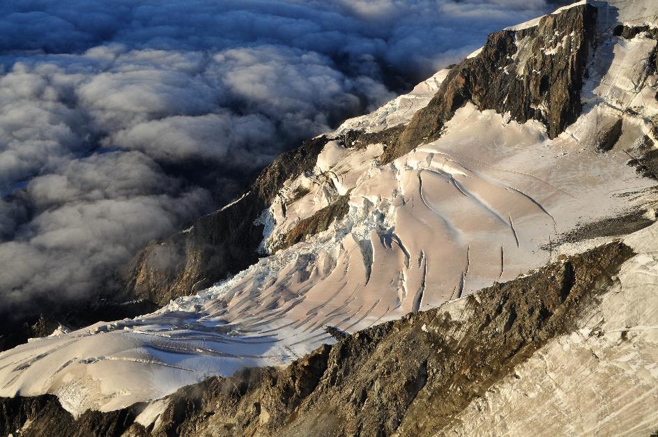
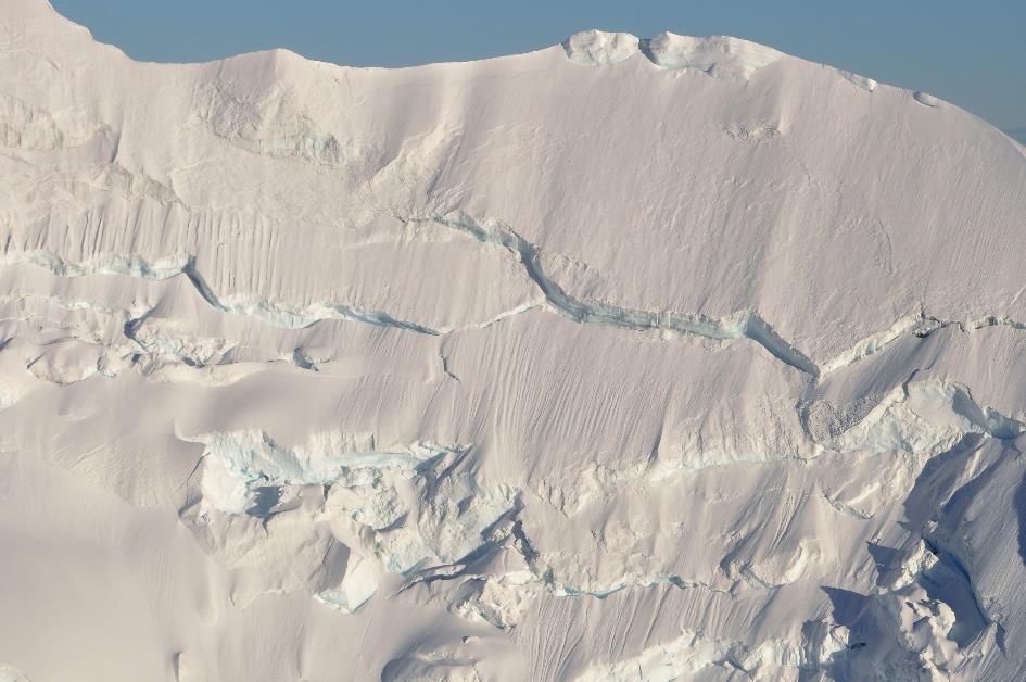
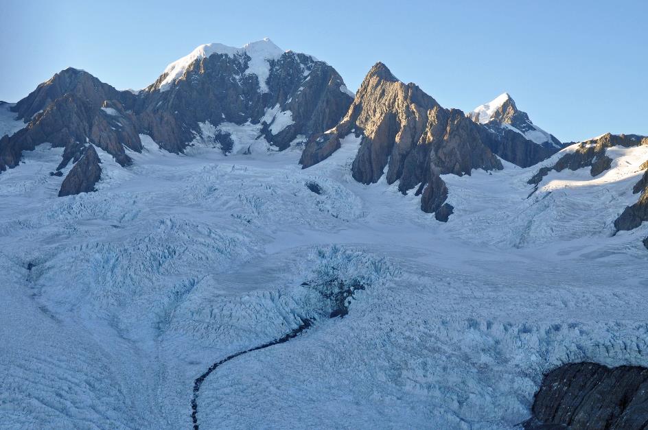
This leads us to the glacier tongue. In fact, there are two, as it turns out. A colossal dark rock splits the ice mass into two almost equal streams. This complicates things for the glacier. The ice has to squeeze through two narrow channels around a bubble in the rocks. This doesn't happen uniformly everywhere; the ice mass cracks and bursts from all sides. It's a rugged situation, with all those glacier crevasses down below. It looks like an enormous bed of nails, but with gigantic blue ice towers instead of nails.
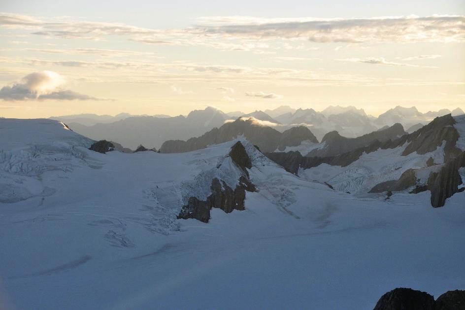
As rugged as the glacier is, the snowfield of 28 km² from which it originates appears perfectly smooth
Fox Glacier – Crevasses
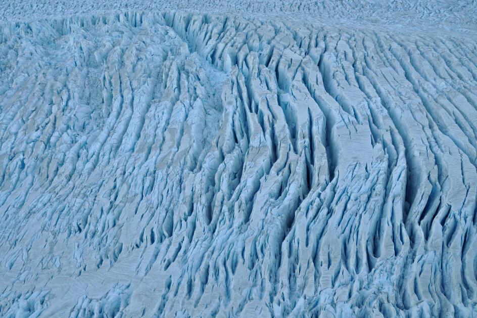
As rugged as the glacier is, the snowfield of 28 km² from which it originates appears perfectly smooth. At an altitude of over two thousand meters, snow accumulates here year after year. Fresh snow compresses the lower layers more and more until eventually ice forms. The longer it takes, the more oxygen is driven out of the ice. This is how the ice gradually turns bluer – blue ice is old ice.
Fox Glacier – Crevasses
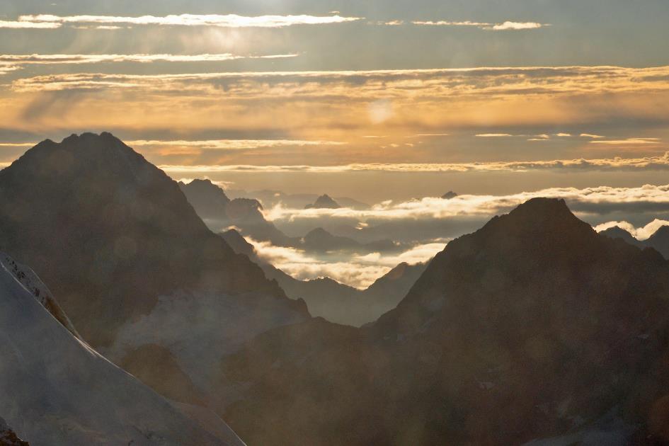
Still, we find ourselves in the shadow of the mountains. Behind the jagged ridge, the last remnants of morning red vanish. A few thin clouds capture the early sunlight. The true magnitude of this scenery becomes fully apparent when we see some pinpricks in motion. Those are the other two helicopters, resembling buzzing mosquitoes in this vast environment.
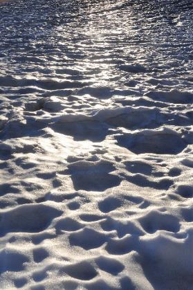
The sun spreads its gentle glow unhindered over the pristine snow
Mount Cook
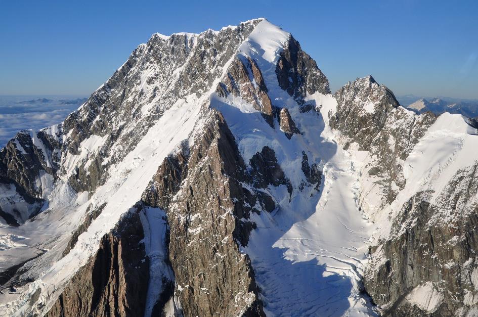
Mount Tasman
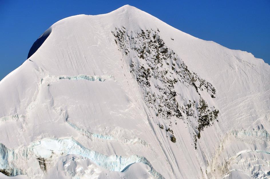
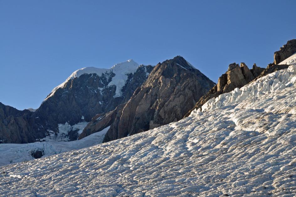
To our left, Jimmy points out The Minarets, a twin-peaked summit at 3,040 meters. He continues to climb higher until we approach the Main Divide, the watershed between the Tasman Sea and the Pacific Ocean. Once we fly over that ridge, the sun comes into view. Before us, the grandeur of the Southern Alps unfolds.
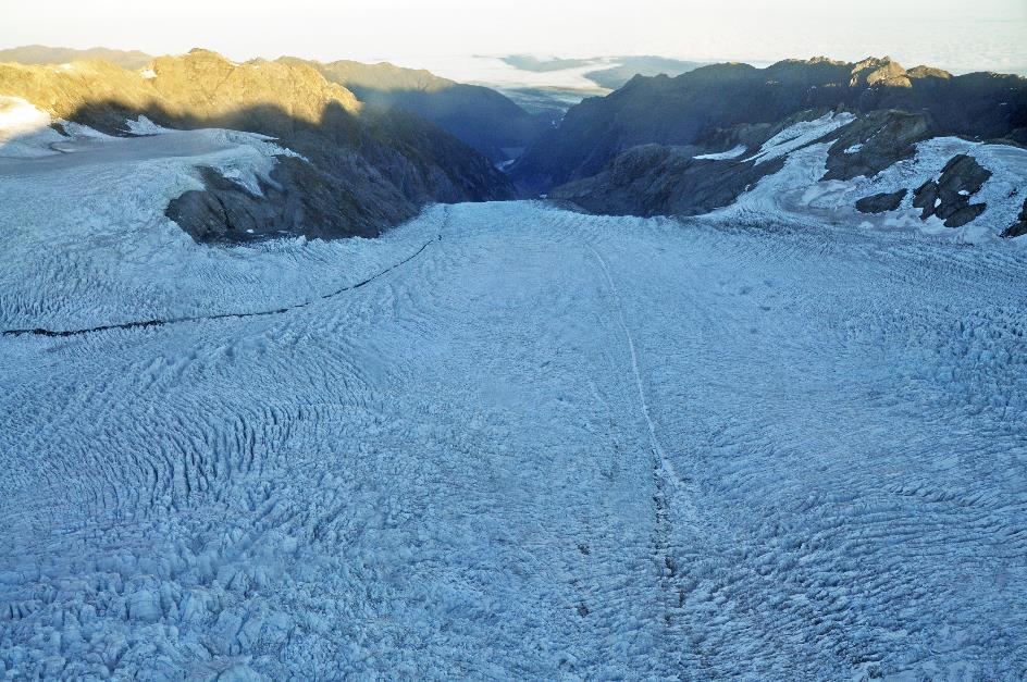
Below lies the snowfield of the Tasman Glacier, spanning 28 km and being the longest glacier in New Zealand. The glacier itself is partially concealed under a layer of clouds lingering in the shadow of the valley. However, the sun reigns supreme on the mountain peaks. Unhindered, it spreads its soft glow over the pristine snow.
|
|
|
Along the mountain ridge, we fly southward, high above the jagged crevasses of the Tasman Glacier. To the right, the snow-covered summit of Mount Tasman passes by, standing at 3,497 meters. However, it's Mount Cook, towering at 3,724 meters, that steals the show.
Head of the Fox Glacier
Between the two peaks, Jimmy navigates his helicopter to the west side of the range. There, he lands the helicopter on the vast snowfield of the Fox Glacier. Unlike the treacherous crevasses of the glacier tongue, it is safe for us to be in the snow here. The other two helicopters also briefly unload their cargo.
In the east, the sun gradually rises above the pointed ridges. The white sea around us gently glistens under the low sunbeams. Jimmy immediately sets to work to immortalize the scene with a group photo. A few moments later, the photos slide out of the printer on board the helicopter.
In 2006, the Fox Glacier even advanced one meter each week
Tongue of the Fox Glacier
Similar to the Franz Josef Glacier, the Fox Glacier is quick to respond to small, local climate fluctuations. For a hundred years, it was receding until it experienced a significant recovery in 1985. In 2006, it even advanced by a meter every week. However, an abrupt halt occurred in 2009, and since then, it has unfortunately been in retreat.
A quarter of an hour later, we ascend again. The long, rugged tongue of the Fox Glacier points the way down. Exactly forty minutes after our departure from Franz Josef Village, Jimmy safely lands his helicopter in Fox Village.
Jaak Palmans
© 2024 | Version 2024-02-03 14:00
Continue reading in (7/11)
Adventure is the name of the game