A stepping stone to Mount Everest
New Zealand | Anno 2019
Sunday, March 24 | Dunedin – Mount Cook National Park
Sunday, March 24 | Dunedin – Mount Cook National Park
Throughout the country, heavy rains are expected – from Auckland on the North Island to Franz Josef on the South Island. In short, everywhere we've been over the past few weeks. But just not where our destinations lie in the coming days. Once again, we narrowly escape bad weather.
On this Sunday morning, the streets of Dunedin lie empty and deserted. For now, the sun barely rises above the horizon. The misty patches thriving between the green hills still elude its attempts to disperse them. Motorcyclists take advantage of the delightful autumn Sunday to venture out.
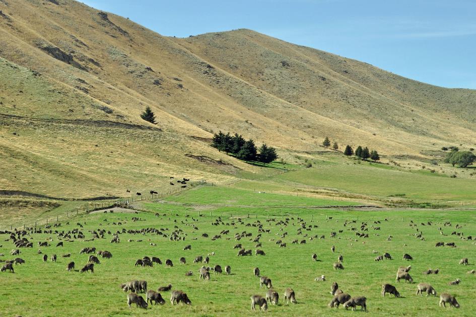
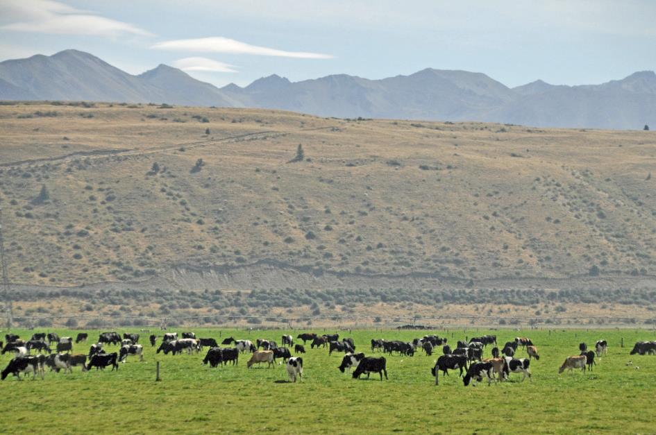
In fact, we're heading northward along SH1, parallel to the coastline. But we don't get to see the sea. Cows, on the other hand, are plentiful. And sheep even more so.
Until near Palmerston in the distance, the tapering hill of Puketapu emerges. We can just make out the monument erected atop the summit, a thirteen-meter-high tower in blue stone. The silhouette strongly resembles that of the Lion of Waterloo.
If you don't work your land, you don't deserve that land, McKenzie used to say
It's a memorial to John McKenzie. As Minister of Lands and Agriculture, he managed to implement significant land reforms at the end of the 19th century. Previously, wealthy landowners held sway here. McKenzie had experienced firsthand how they treated poor farmers, having grown up as the five-year-old son of a farmer in Scotland.
More than 320,000 hectares (800,000 acres) of land were unlocked by the new legislation. Around seven thousand farmers gratefully took advantage of this to settle there with their families. The countryside was revitalized. Gradually, New Zealand transitioned from a form of plantation agriculture to family farming.
What's more, McKenzie ensured that every Kiwi, regardless of rank or status, had unlimited access to mountains and forests, and could fish freely in rivers and lakes. As a matter of fact, we still benefit from that today.
But that glorious medal had a bitter flip side. Large landowners were generously compensated for the properties they had to relinquish. Māori, on the other hand, received nothing. If you don't work your land, you don't deserve that land, McKenzie used to say about it.
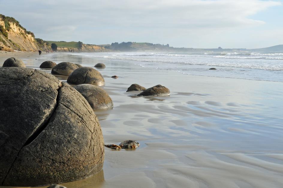
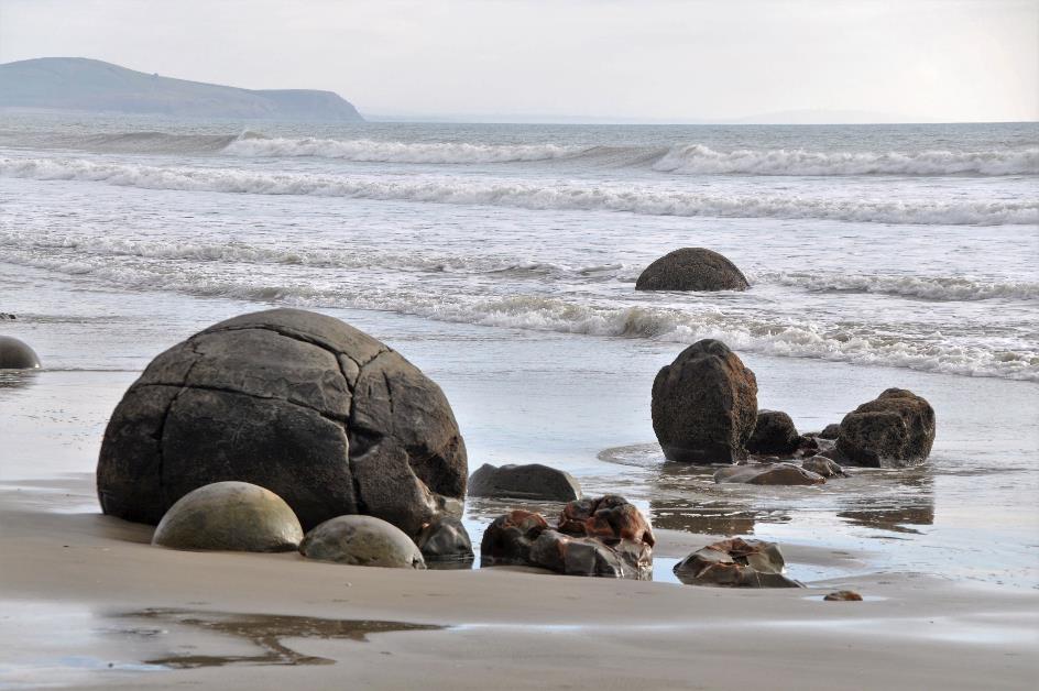
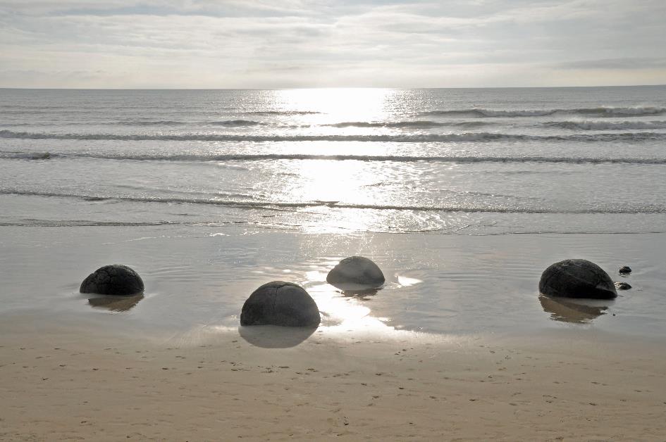
It looks like a load of gigantic chocolate marshmallow teacakes washed up on the beach
Moeraki Boulders
Nearly an hour into our journey, the Pacific Ocean reappears on the right-hand side. The SH1 now neatly winds along the coastline. However, something peculiar happens near Moeraki. It looks like a load of gigantic chocolate marshmallow teacakes washed up on the beach. These are the famous Moeraki Boulders, about fifty perfectly spherical rocks half-buried along the shoreline. The largest boulder has a diameter of a whopping two meters.
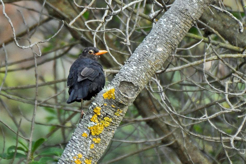
Common blackbird
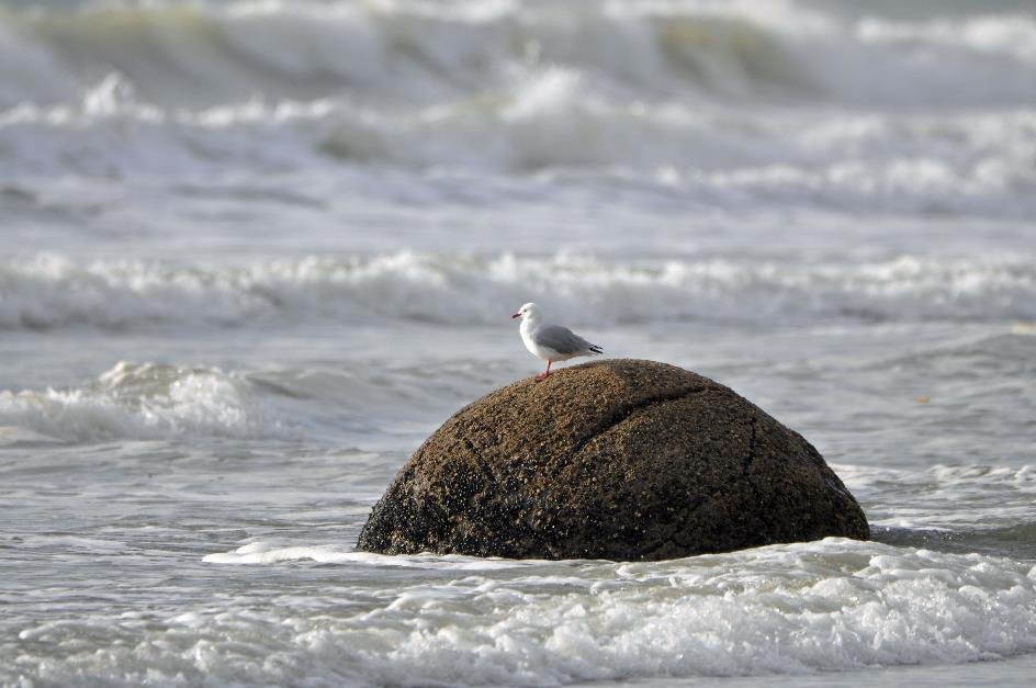
Curiously, we descend to the beach. The morning sun hangs low above the horizon, casting a silvery shimmer over the tumultuous surf. The dark spherical silhouettes create enchanting scenes in the morning light. Perched on one of the largest boulders, a red-billed gull observes the rolling waves. Amidst the bushes, a blackbird ponders what all these strange creatures are doing here. We can't blame him, especially when we witness the selfie-taking frenzy of a busload of Japanese tourists among and atop the boulders.
Red-billed gull on a boulder
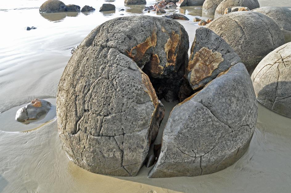
Upon closer inspection, the boulders are found to have cracks, often running like meridians across their surface. Occasionally, a boulder has even fragmented into pieces, revealing that its interior seems to be made of a different material.
Boulders that are beautifully rounded and smoothed must have undergone erosion, there's no other explanation. We're familiar with this phenomenon from the millions of smooth, rounded boulders found in the moraine of any glacier. Here lies our first misconception.
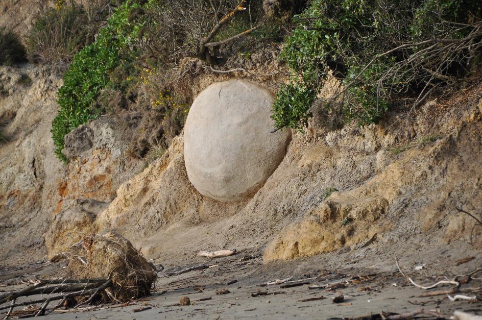
Our second misconception is that these boulders originated from the sea in front of us. Instead, they emerged from the dunes behind us. This becomes abundantly clear when we discover a boulder protruding halfway from the dune slope, as if eager to break free.
Boulders that are beautifully rounded and smoothed must have undergone erosion. There lies our first misconception
Internal structure of the boulders
Boulder protruding from the dune slope, as if eager to break free
What is happening here then? To understand that, we need to go back 65 million years in time. The dinosaurs had just kicked the bucket, and Otago was largely at the bottom of the sea.
Over millions of years, the sediment layer on the bottom of that sea became thicker and thicker. Mud, shells, organic remains of plants and animals, everything sank to the seabed.
The dinosaurs had just kicked the bucket, and Otago was largely at the bottom of the sea
Nothing unusual about that, except that various sea creatures enjoyed digging into that sediment in search of food – marine worms, molluscs, sea urchins, ... The result of all that digging was that the sediment layers were thoroughly mixed up. Minute particles of various kinds thus came into contact with each other.
For calcite, this was a boon. In the moist sediment, the temperature and pressure were suitable for crystallization. But then that calcite had to find a place to settle. If enough saturated calcite was present near a shell, then the process could begin. The calcite deposited on the shell from all sides, creating a spherical shape that grew larger and larger. Geologists call this process diagenesis. It occurs all over the world.
However, we shouldn't exaggerate the speed at which this happened. It took 120,000 years for a boulder with a diameter of half a meter, and the colossal ones with a diameter of two meters needed even four million years for nature to complete its work. These giants weigh seven tons.
With the growth of the boulders came also the growing pains. On the outside, they became hard and brittle, while dehydration took its toll inside. The calcite crystals lost the little water they had, causing them to shrink and inevitable cracks to form in the boulder.
Oh, the irony, as these cracks were filled once again with graphite. Initially, these were small brown crystals, but over time, even the large yellow calcite crystals joined in. Thus, the differently coloured layers we observe in the cracked stones were formed.
It can be stated with certainty that there are still dozens, if not hundreds, of such giants hidden in the sand dunes behind us
But we must not lose sight of time, for now we are fifty million years later. About fifteen million years ago, this area was gradually uplifted and came to the surface.
The coalition of sun, sea, and wind could now begin erosion. Over the past millions of years, some boulders gradually became exposed on the beach. It can be stated with certainty that there are still dozens, if not hundreds, of such giants hidden in the sand dunes behind us.
Shortly after ten o'clock, we leave the Moeraki Boulders behind us. Once again, in the distance, a lookalike of the Lion of Waterloo passes by the window. This time it's a monument for Thomas Brydone, known as the father of the frozen meat export industry. In 1882, he sent the first ship with frozen sheep meat from New Zealand to England. The cargo arrived in excellent condition about a hundred days later. This was a significant turning point for sheep farming, as the animals were now bred not only for their wool but also for their meat. Interestingly, around the same time, the Argentinians also began sending refrigerated ships to Europe, but with frozen beef on board.
In gratitude for Brydone's contributions, this monument was erected on Sebastopol Hill near Totara in 1907. The tower stands eleven meters high, entirely constructed from limestone quarried from Oamaru. Today, the flag flies at half-mast, a tribute to the tragic events in Christchurch.
As expected, in the rural town of Oamaru, houses made of pale limestone set the tone. Rarely do these buildings have more than one floor. New Zealand has plenty of space, so there's no need to build upward.
Shortly after, we turn away from the Pacific Ocean and SH1. We have just over two hundred kilometres ahead of us. A journey across the island will take us to the foot of Mount Cook, at 3,724 meters the highest mountain in New Zealand. Last Tuesday, we looked down on its northern slopes from a helicopter, and soon we'll be gazing up at it from the south.
We are in the rain shadow of the Southern Alps. Irrigation is therefore constantly necessary
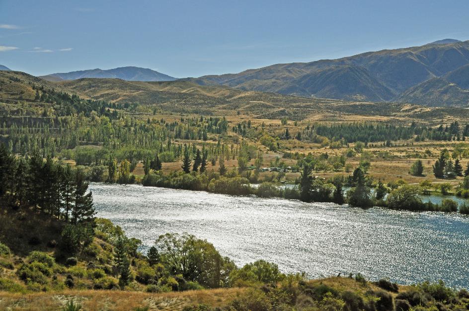
The Waitaki River valley will guide us through the mountains. Almost straight, the meandering river flows through an immense sediment plain towards the sea. Here and there, cows graze on fertile green pastures.
That may seem like the most ordinary thing in the world, but it's not. Because we are in the rain shadow of the Southern Alps. So, you shouldn't expect much rain here. And in summer, temperatures can soar – up to 30 °C (86 °F) or more. For agriculture, this is a fatal combination. Irrigation is therefore constantly necessary. In the fields, we see enormous irrigation systems on wheels. Segments of 20 to 30 meters long are linked together, sometimes over a length of half a kilometre. Hydraulic drive systems steer them fully automatically across the fields, and some even have GPS.
Its central location made the Waitaki River gorge an ideal candidate for dams
Waitaki Valley
At Kurow, we take a break. Gradually, the wide valley narrows into a gorge through the mountains. Around 1925, the government found it ideal for hydroelectric power stations. Because a capacity shortage on the electricity grid was gradually being felt on the South Island. Its central location made this gorge an ideal candidate for dams, as electricity would no longer need to be transported far.
Moreover, a global recession was looming. Any form of employment was welcome. In 1928, 1,230 workers were employed. Wheelbarrows, shovels, and pickaxes were the weapons they used to tackle the rocks. The working conditions were dire. Eleven workers would lose their lives, and many would suffer serious injuries. That was inevitable with such construction projects, was the prevailing opinion.
David McMillan thought differently. As a young doctor, he offered free medical treatment to workers and their families. In return, they were required to contribute a small amount to a common fund each week. This led to a modest form of social security that would later serve as a model for New Zealand's National Health Service.

Waitaki River, Aviemore Reservoir
In 1934 was the dam on the Waitaki River completed – the last hydroelectric power station to be built without mechanical aids. The dam does not have a spillway. If there is too much water in the reservoir, it simply flows over the edge. Frivolities such as a fish ladder were also not in line with the prevailing attitudes of the time. As a result, eels and salmon saw their access to the upper reaches of the Waitaki River cut off.
As a young doctor, David McMillan offered workers and their families free medical treatment
From a braided river with channels and sandbanks, the Waitaki River transformed into a steadily flowing body of water. Endemic species such as the black stilt, the wrybill, and the black-fronted tern saw their favourite habitats disappear.
And it didn't stop there. In 1965, the Benmore Dam upstream was put into operation, followed by the Aviemore Dam in 1968. Together, they have a capacity of 865 MW.
Aviemore Reservoir |
|
Water supply for the turbines |
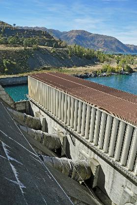
At the Aviemore hydroelectric power station, we take a moment to have a look around. The strong wind whips up the water. It's far from being the calm, mirror-like lake we've become accustomed to. Restless waves splash against the dam. Above it all, the cloudless blue sky dominates, with the sun shining brightly.
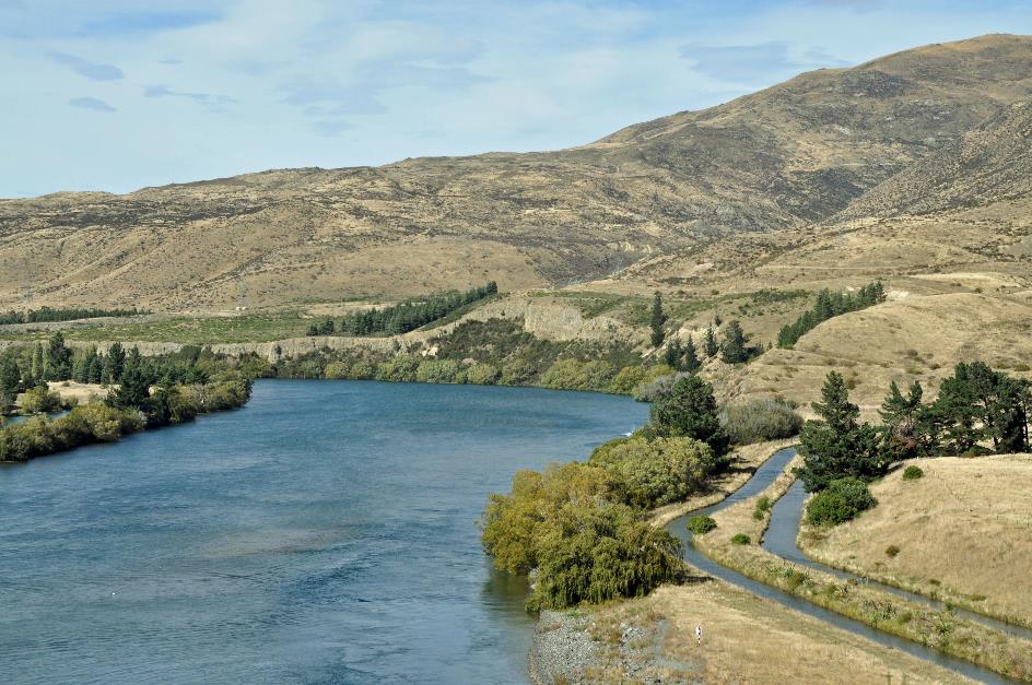
We look down at four enormous pipes that carry water to the powerhouse. With a diameter of seven meters, they are the largest you can find in New Zealand. On the right bank, we notice two water channels that seem to act as a fish ladder after all.
Waitaki River, fish ladders (on the right)
Shortly after, we pass through Otematata. It's a tiny settlement, with barely more than a hundred permanent residents. Otematata almost ceased to exist altogether. When the Electricity Corporation of New Zealand established this settlement in 1958, its sole purpose was to provide housing and utilities for its workers. Once the dams were completed, the intention was to close down the settlement.
Aviemore Reservoir
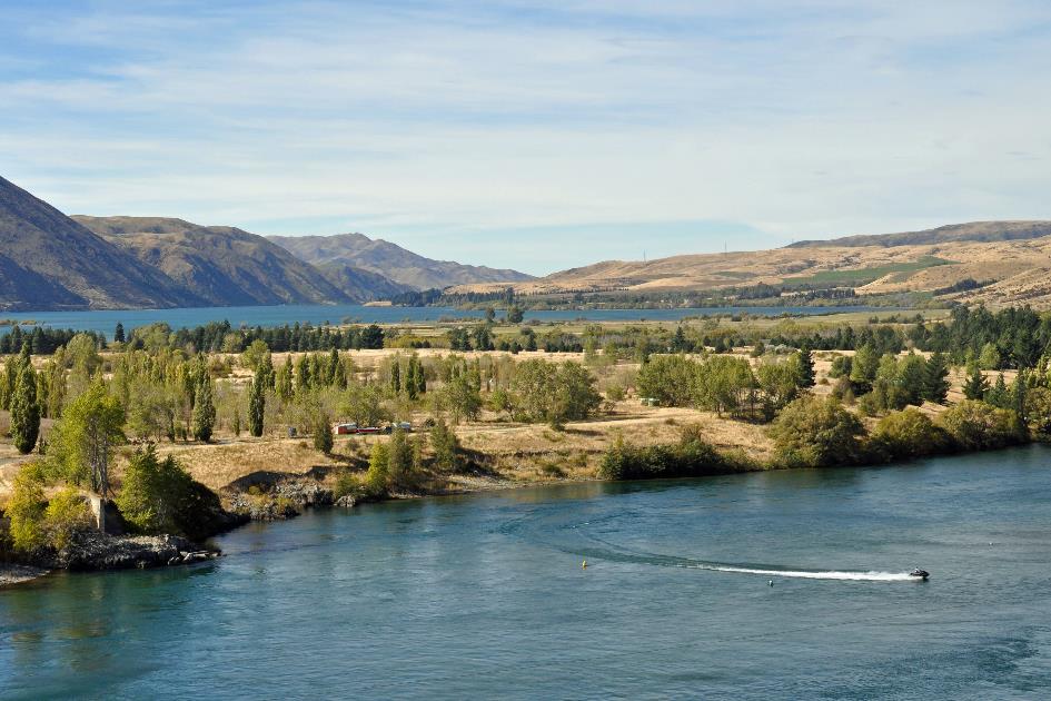
But when it came down to it, the last residents didn't want to hear about it. Otematata had to stay. They succeeded in their resistance, and Otematata remained where it was. Simply because of its charming name, we believe that place has a right to exist. Nowadays, it's mainly a holiday destination for water sports enthusiasts. During the summer peak between Christmas and New Year, around five thousand Kiwis flock here.
The presence of canals in this remote, mountainous area is quite surprising
Once past Omarama, we leave the Waitaki Valley behind us. Through a wide, straight valley, we now head due north. We cross the Ohau B Canal, and soon the Pūkaki-Ohau Canal.
The presence of canals in this remote, mountainous area is quite surprising. But Kiwis shouldn't be underestimated, as we've come to learn. They call these shallow canals power canals. They aren't meant for navigation. In fact, they serve as a sophisticated bypass of natural rivers. The water supply in the canals is fairly constant, so it's worthwhile to build hydroelectric power stations there, albeit small ones. There are five of them in total. This brings the total number of hydroelectric power stations in the Waitaki River catchment area to eight. Together, they have a capacity of 1,735 MW.
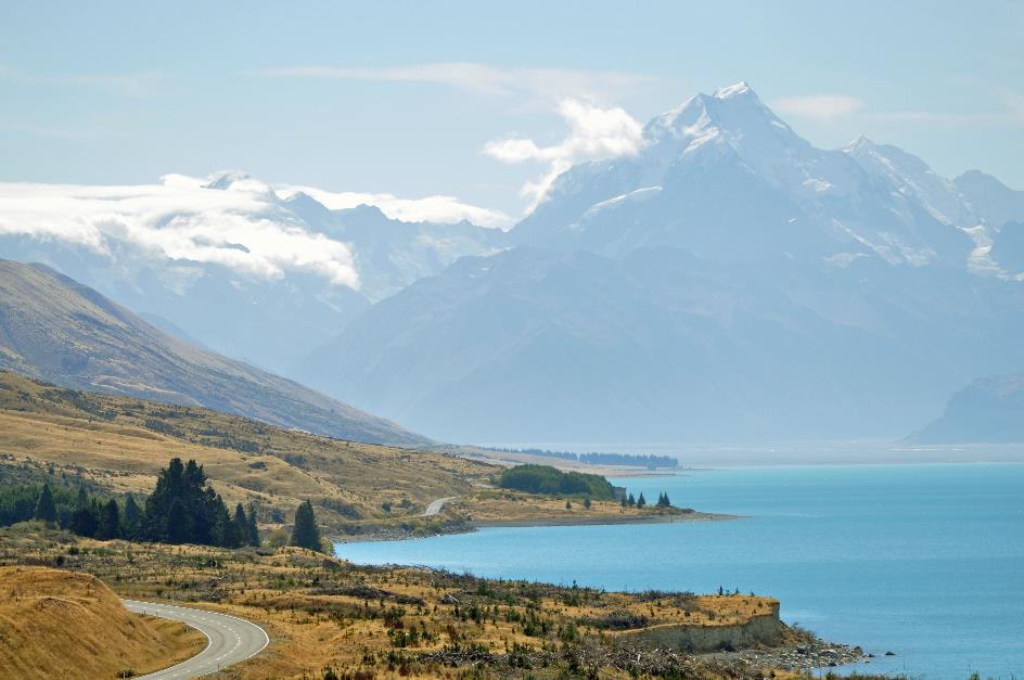
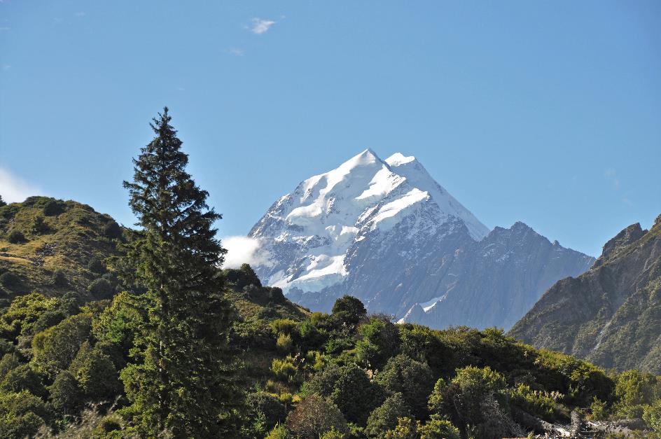
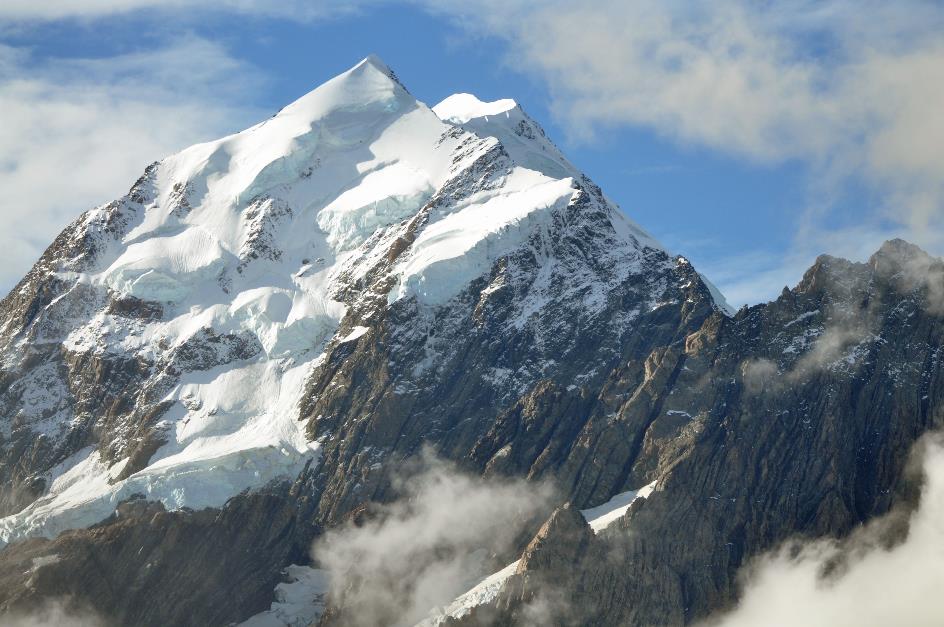
Above the turquoise lake, the deep blue silhouette of Mount Cook dominates the horizon
Lake Pūkaki – Mount Cook at a distance of 50 km
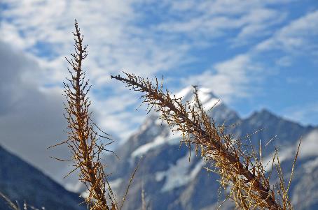
Gradually, the moment we've been waiting for is approaching, the moment when we can catch our first glimpse of Mount Cook. And it comes much sooner than expected. Before we even reach Twizel, there it is. On the distant horizon, the famous profile of the snow-capped peak appears. Directly ahead of us, just above the foothills of the Ben Ohau Range, we recognize the deep blue silhouette of New Zealand's highest mountain. It stands sharply against the steel-blue sky as if it were just around the corner, at an incredible distance of 75 km.
In the 1980s, the residents of Twizel managed to save their town from the bulldozers
Twizel has much in common with Otematata. A dormitory town and a service centre for construction workers, that's all it was meant to be when the town was established in 1968. Once the power canals and the hydroelectric power stations were completed, the houses would give way to farmland. Most facilities were therefore temporary. Telephone cables and electrical wires were hung on poles instead of buried underground. Houses were prefabricated for easy relocation.
But just like in Otematata, the residents of Twizel managed to save their town from the bulldozers in the 1980s. Nowadays, it is the tourist hub of the region. They could rightfully call themselves the gateway to Mount Cook National Park – although they don't.
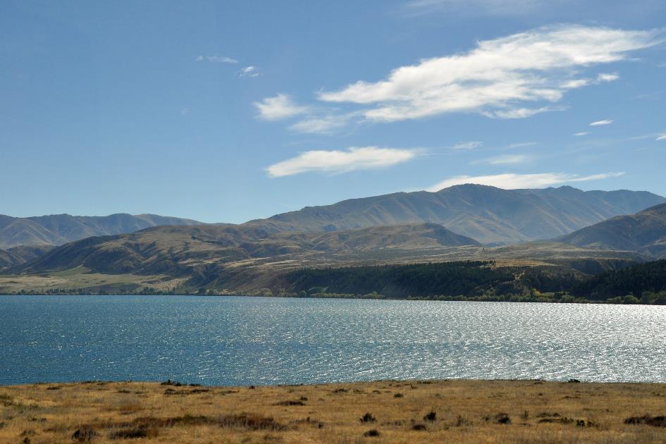
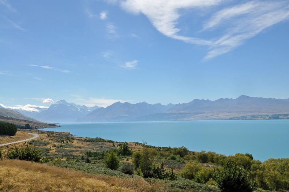
It doesn't take long before a long stretch of lake appears on our right side. It's a glacier lake, trapped behind the high terminal moraine as the glacier gradually retreated. That's why the Māori call the lake Pūkaki – stacked water.
It's of unearthly beauty, this turquoise water surface
Peters Lookout – Lake Pūkaki
But it's the colour of the water that fascinates us endlessly. This turquoise water surface possesses an otherworldly beauty. We owe this to the tiny rock particles suspended in this crystal-clear water. All day long, the blazing sun casts its intense rays upon them. Each time a sunbeam is reflected by one of these particles, it undergoes a slight shift in colour towards blue. The result is a turquoise lake that has few equals. Remarkably, the lake never freezes, even when the air temperature reaches –20 °C (–4 °F).
On the slopes of Mount Cook, Edmund Hillary used to intensively practice mountain climbing – a stepping stone to Mount Everest, so to speak
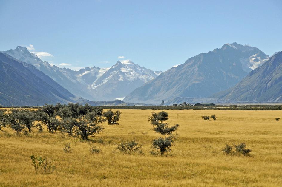
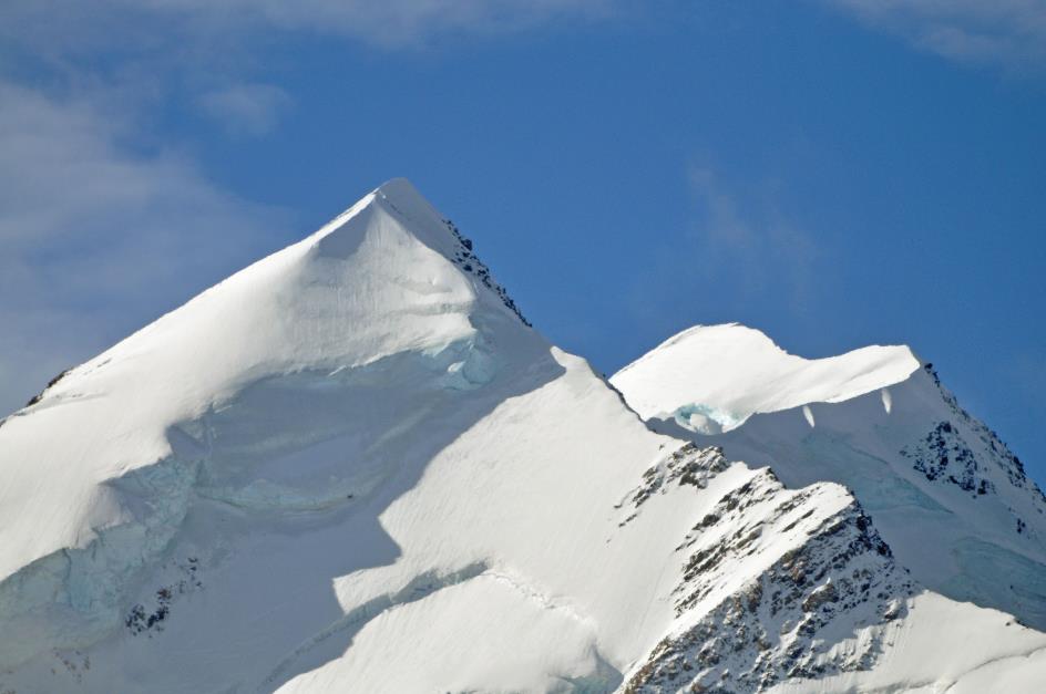
Thus, we're gradually approaching the Mount Cook National Park. With an area of 722 km², it is one of the smallest national parks in the country. At the same time, it is one of the most remarkable. New Zealand boasts twenty-six peaks higher than three thousand meters, and twenty-five of them are located in this national park.
Overall, the mountains of the Southern Alps are relatively young in geological terms, with most having nearly ten million years on the clock. They are still steadily being pushed upward, at an average rate of five to ten millimetres per year. If we were to extrapolate their height based on this rate, they should be several tens of kilometres high by now. However, that's discounting erosion. Scientists estimate that these mountain peaks would be twenty-five kilometres high if erosion didn't affect them.
But of course, it's Mount Cook that steals the show. From Peter’s Lookout, we see it in all its glory, still over fifty kilometres away from us. Its deep blue silhouette dominates the horizon above the turquoise lake. The sun sparkles like never before in the cloudless sky. It's a sight to behold.
Peter Hillary is the man after whom this viewpoint is named. He is the son of Sir Edmund Hillary, the New Zealander who, along with the Nepalese Tenzing Norgay, first conquered Mount Everest in 1953. Here, on the slopes of Mount Cook, father Hillary used to intensively practice mountain climbing – a stepping stone to Mount Everest, so to speak.
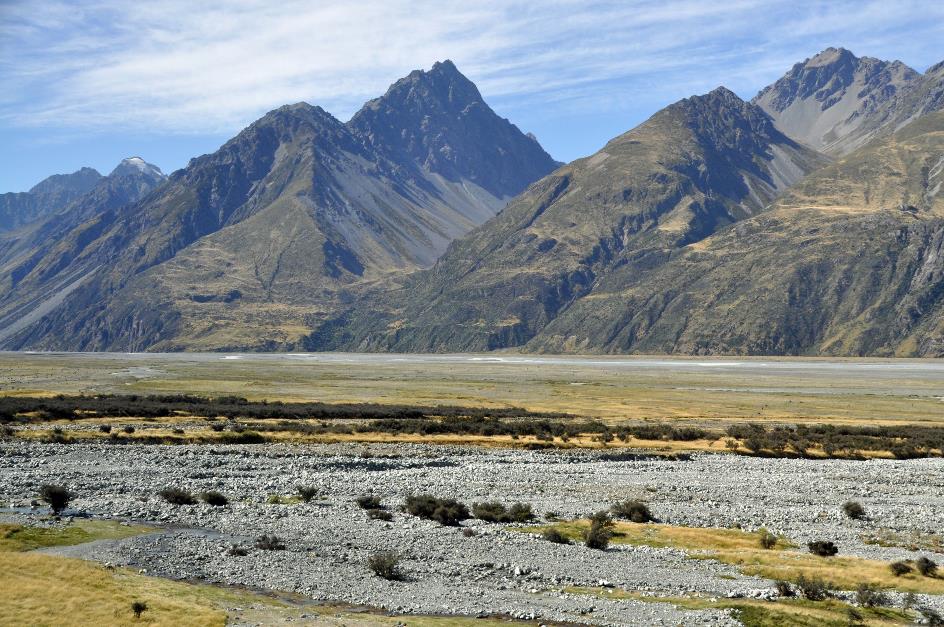
It must be a surreal spectacle in spring when meltwater rushes through the four-kilometre-wide bed
Tasman River bed
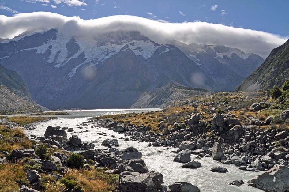
Continuing our journey northward along the shore of Lake Pūkaki, we venture deeper into the valley. Then, the glacier-fed lake transitions into the mostly dry bed of the Tasman River. The numerous channels of the braided river calmly meander their way through it. It must be a surreal spectacle in spring when meltwater rushes down the full width of four kilometres.
Tasman Valley
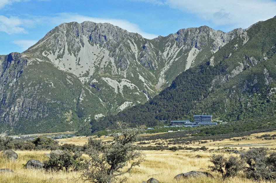
Just before three o'clock, we reach The Hermitage Hotel, situated 760 meters above sea level. As the crow flies, we are still 15 kilometres away from Mount Cook. Similar to its famous counterpart on the North Island, the Chateau Tongariro Hotel, this hotel owes its fame primarily to its unique location – right in the heart of the national park, overlooking Mount Cook.
They realized this already in 1884 when they built the first Hermitage Hotel here. Out of necessity, it was built with adobe, a mixture of sand, clay, water, and straw. Guests arrived by horse-drawn carriage. In 1913, the primitive structure was swept away by a flood. A year later, The Hermitage 2.0 stood in its place. Disaster struck again in 1957 when the hotel was completely destroyed by fire. Barely eight months later, The Hermitage 3.0 opened its doors. This is the version where we will be staying, although the hotel has undergone several expansions and renovations since then.
At the end of the 19th century, guests arrived by horse-drawn carriage
The Hermitage Hotel
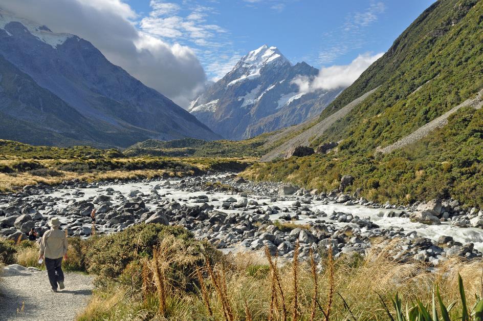
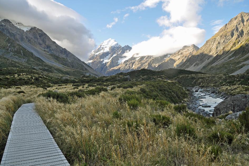
The view of Mount Cook from the rooms is indeed magnificent. But we didn't come here to admire His Snowy Majesty from behind glass. So let's get dropped off at the foot of White Horse Hill, the starting point of the Hooker Valley Track. It's a five-kilometre walk to Hooker Lake, through one of the most accessible areas of the park.
Hooker Valley Track – Terminal Moraine of the Mueller Glacier, Mount Cook
Just after half past three, we hit the trail. It's not difficult, as the Kiwis, like elsewhere, have constructed an excellent hiking path – a gravel boulevard, so to speak.
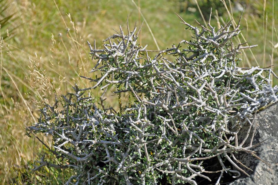
Matagouri
Next to the trail grows the native matagouri. It appears to be an unimaginable tangle of thorny branches, a maze of shrubs that can grow up to five meters high and are virtually impenetrable. The Māori were well aware of this. They used to use them to fortify their pās or forts.
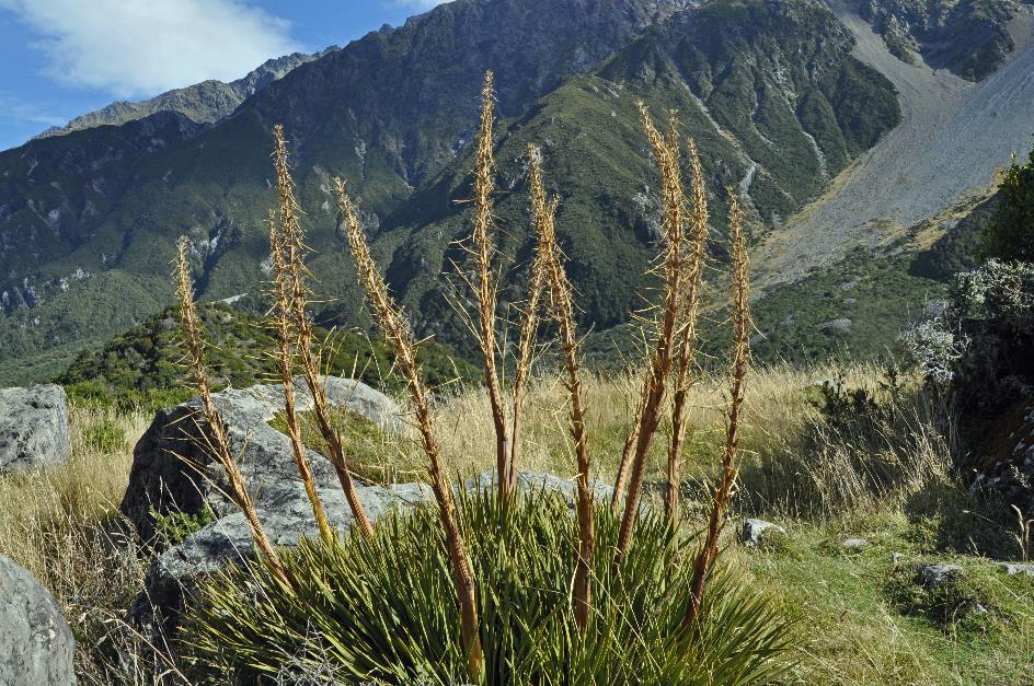
Giant speargrass
The native giant speargrass is also present. Its name comes from the impressive wooden sticks that emerge from the spherical cushion of long, green leaves. In fact, these are flower stems, but the beautiful yellow flowers have long withered. Now, only the many sharp thorns, up to ten centimetres long, remain. The Māori made use of these when they wanted to dissuade approaching enemies. They called these plants taramea. Both matagouri and taramea are only found at altitudes above seven hundred meters.
Giant speargrass |
|
|
If you come here between December and February, you can enjoy a magnificent display of flowers. One stands head and shoulders above her counterparts – the Mount Cook Lily. She is undoubtedly the prima donna of the subalpine flora. Nowhere else but in the Southern Alps can you find her. However, she is not actually a lily but a buttercup. Nonetheless, she is the largest of all buttercups, reaching up to a meter in height.
Unfortunately, this native vegetation is still threatened by introduced plant species. Common broom and lupins, in particular, thrive here. Perhaps a little too well.
In principle, you can also find trees at this altitude, but in the Hooker Valley, it's not so easy. This is mainly due to the terrain. For a fledgling tree, taking root in the rocky soil or one of the many moraines is no easy feat.
Our path gradually ascends parallel to a ridge until we reach the top, where we realize that this is the end moraine of the Mueller Glacier. Below lies the glacier lake sparkling in the sun. At our feet, the frothy white water of the Hooker River rushes between the rocks. Behind us, The Hermitage is just visible in the distance.
A layer of bright white clouds has settled like a warm blanket over the mountain peaks
Mueller Glacier Lake
Hooker River, Mount Cook
At the other side of the valley, a layer of bright white clouds has settled like a warm blanket over the mountain peaks. These clouds are being pushed up from the west but, for some reason, they fail to reach our valley. Fortunately, as long as they linger up there, they cannot release their moist cargo above us.
The Lower Hooker suspension bridge takes us across the river. We continue our journey over the glacier's end moraine. Soon, the Hooker Bluff suspension bridge comes into view. Along the Hooker River, we proceed upstream. The bluish-grey water of the river struggles its way through a gorge.
Mount Cook is still more than twelve kilometres away from us
Mount Cook is now temporarily out of sight. It won't be long before it reappears from behind the Mount Cook Range, grander than ever, with its steep, bare rock walls and its white, triangular peak. However, it is still more than twelve kilometres away from us.
The terrain becomes somewhat marshy now, but that doesn't deter the Kiwis. A comfortable boardwalk replaces the gravel path.
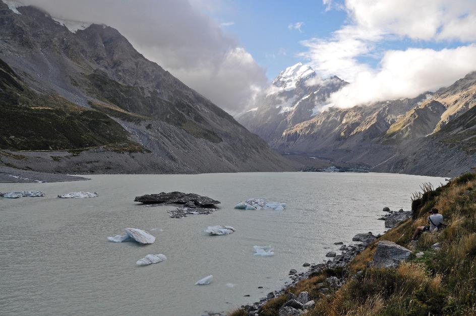
A final suspension bridge, the Upper Hooker Suspension Bridge, brings us to the base of the terminal moraine of the Hooker Glacier. A short climb eventually takes us to Hooker Lake, approximately 880 meters above sea level. In the milky-coloured water, there are still some ice floes floating. Here too, Mount Cook dominates the scene, although white clouds seem to be gathering to gradually obscure it from our view.
In the milky-coloured water, there are still some ice floes floating
Hooker Lake
A glacier lake at the foot of a glacier may seem obvious, but it's not a given. This glacier lake is actually of very recent origin. It only began to form in the late 1970s. The reason for this can be found with the Hooker Glacier. It started to gradually retreat, and there seems to be no end in sight. Year after year, the glacier gets shorter and the lake gets longer – 1.2 km in 1990, 2.3 km in 2013.

Mount Cook, Hooker River
Shortly after six, we're back at the parking lot. The round trip took two and a half hours of walking.
At The Hermitage Hotel, you’re supposed to leave the curtains in your room open at night. That's how the tradition goes. Because then you wake up the next day with a magnificent view of Mount Cook.
You’re supposed to leave the curtains in your room open at night. That's how the tradition goes
But for the first time in almost two weeks, luck isn't on our side. A magnificent view of black, dark clouds low over the valley, that's our first sight when we wake up in the morning. There's no trace of Mount Cook anymore.
Jaak Palmans
© 2024 | Version 2024-02-06 14:00
Continue reading in (11/11)
City in transition